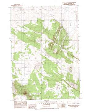
Imperial Valley South Topo Map Oregon
To zoom in, hover over the map of Imperial Valley South
USGS Topo Quad 43120f4 - 1:24,000 scale
| Topo Map Name: | Imperial Valley South |
| USGS Topo Quad ID: | 43120f4 |
| Print Size: | ca. 21 1/4" wide x 27" high |
| Southeast Coordinates: | 43.625° N latitude / 120.375° W longitude |
| Map Center Coordinates: | 43.6875° N latitude / 120.4375° W longitude |
| U.S. State: | OR |
| Filename: | o43120f4.jpg |
| Download Map JPG Image: | Imperial Valley South topo map 1:24,000 scale |
| Map Type: | Topographic |
| Topo Series: | 7.5´ |
| Map Scale: | 1:24,000 |
| Source of Map Images: | United States Geological Survey (USGS) |
| Alternate Map Versions: |
Imperial Valley South OR 1983, updated 1983 Download PDF Buy paper map Imperial Valley South OR 2011 Download PDF Buy paper map Imperial Valley South OR 2014 Download PDF Buy paper map |
1:24,000 Topo Quads surrounding Imperial Valley South
> Back to 43120e1 at 1:100,000 scale
> Back to 43120a1 at 1:250,000 scale
> Back to U.S. Topo Maps home
Imperial Valley South topo map: Gazetteer
Imperial Valley South: Flats
Braken Flat elevation 1446m 4744′Grassy Lake elevation 1498m 4914′
Johnson Flat elevation 1358m 4455′
Mud Lake elevation 1488m 4881′
Ram Lake elevation 1441m 4727′
Skull Lake elevation 1506m 4940′
Sunflower Flat elevation 1449m 4753′
Sunflower Lake elevation 1442m 4730′
Imperial Valley South: Populated Places
Imperial (historical) elevation 1375m 4511′Imperial Valley South: Post Offices
Imperial Post Office (historical) elevation 1376m 4514′Imperial Valley South: Reservoirs
Meeks Waterhole elevation 1436m 4711′Ram Lake South Waterhole elevation 1441m 4727′
Ram Lake Waterhole elevation 1441m 4727′
Rim Waterhole elevation 1426m 4678′
Imperial Valley South: Streams
Rimrock Creek elevation 1349m 4425′Imperial Valley South: Summits
Bronco Butte elevation 1487m 4878′Corral Butte elevation 1637m 5370′
Coyote Rock elevation 1382m 4534′
Imperial Valley South: Valleys
Espeland Draw elevation 1364m 4475′Imperial Valley South: Wells
Burns Well elevation 1395m 4576′Cody Well elevation 1387m 4550′
Dominick Well elevation 1424m 4671′
Nershal Well elevation 1455m 4773′
Peters Well elevation 1405m 4609′
Imperial Valley South digital topo map on disk
Buy this Imperial Valley South topo map showing relief, roads, GPS coordinates and other geographical features, as a high-resolution digital map file on DVD:


