Dickerson Flat Topo Map Oregon
To zoom in, hover over the map of Dickerson Flat
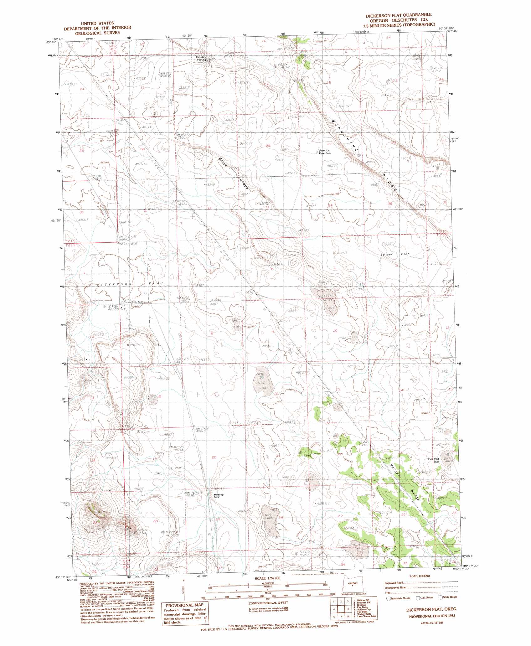
USGS Topo Quad 43120f6 - 1:24,000 scale
| Topo Map Name: | Dickerson Flat |
| USGS Topo Quad ID: | 43120f6 |
| Print Size: | ca. 21 1/4" wide x 27" high |
| Southeast Coordinates: | 43.625° N latitude / 120.625° W longitude |
| Map Center Coordinates: | 43.6875° N latitude / 120.6875° W longitude |
| U.S. State: | OR |
| Filename: | o43120f6.jpg |
| Download Map JPG Image: | Dickerson Flat topo map 1:24,000 scale |
| Map Type: | Topographic |
| Topo Series: | 7.5´ |
| Map Scale: | 1:24,000 |
| Source of Map Images: | United States Geological Survey (USGS) |
| Alternate Map Versions: |
Dickerson Flat OR 1983, updated 1983 Download PDF Buy paper map Dickerson Flat OR 2011 Download PDF Buy paper map Dickerson Flat OR 2014 Download PDF Buy paper map |
1:24,000 Topo Quads surrounding Dickerson Flat
Millican |
West Butte |
Rodman Ridge |
Sugarloaf Butte |
Pringle Flat |
Pine Mountain |
Millican Se |
Brothers Sw |
Brothers |
Imperial Valley North |
Firestone Butte |
Plot Butte |
Dickerson Flat |
Soldiers Gap |
Imperial Valley South |
Sixteen Butte |
Fox Butte |
Walker Butte |
Last Chance Lake |
Frederick Butte |
Cougar Mountain |
Hogback Butte |
Jacks Place |
Peters Creek Sink |
Mean Rock Well |
> Back to 43120e1 at 1:100,000 scale
> Back to 43120a1 at 1:250,000 scale
> Back to U.S. Topo Maps home
Dickerson Flat topo map: Gazetteer
Dickerson Flat: Flats
Dickerson Flat elevation 1464m 4803′Spicer Flat elevation 1473m 4832′
Two Post Lake elevation 1496m 4908′
Dickerson Flat: Reservoirs
Pumice Waterhole elevation 1473m 4832′Dickerson Flat: Ridges
Berger Ridge elevation 1504m 4934′Black Ridge elevation 1480m 4855′
Moonshine Ridge elevation 1501m 4924′
Dickerson Flat: Springs
Whiskey Spring elevation 1458m 4783′Dickerson Flat: Summits
Whiskey Rock elevation 1477m 4845′Dickerson Flat: Wells
Dickerson Well elevation 1465m 4806′Dickerson Flat digital topo map on disk
Buy this Dickerson Flat topo map showing relief, roads, GPS coordinates and other geographical features, as a high-resolution digital map file on DVD: