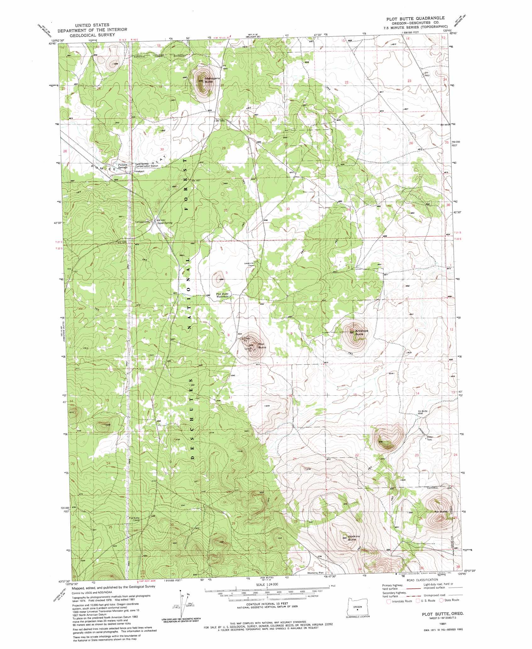
Plot Butte Topo Map Oregon
To zoom in, hover over the map of Plot Butte
USGS Topo Quad 43120f7 - 1:24,000 scale
| Topo Map Name: | Plot Butte |
| USGS Topo Quad ID: | 43120f7 |
| Print Size: | ca. 21 1/4" wide x 27" high |
| Southeast Coordinates: | 43.625° N latitude / 120.75° W longitude |
| Map Center Coordinates: | 43.6875° N latitude / 120.8125° W longitude |
| U.S. State: | OR |
| Filename: | o43120f7.jpg |
| Download Map JPG Image: | Plot Butte topo map 1:24,000 scale |
| Map Type: | Topographic |
| Topo Series: | 7.5´ |
| Map Scale: | 1:24,000 |
| Source of Map Images: | United States Geological Survey (USGS) |
| Alternate Map Versions: |
Plot Butte OR 1981, updated 1982 Download PDF Buy paper map Plot Butte OR 2011 Download PDF Buy paper map Plot Butte OR 2014 Download PDF Buy paper map |
| FStopo: | US Forest Service topo Plot Butte is available: Download FStopo PDF Download FStopo TIF |
1:24,000 Topo Quads surrounding Plot Butte
Horse Ridge |
Millican |
West Butte |
Rodman Ridge |
Sugarloaf Butte |
Evans Well |
Pine Mountain |
Millican Se |
Brothers Sw |
Brothers |
China Hat |
Firestone Butte |
Plot Butte |
Dickerson Flat |
Soldiers Gap |
South Ice Cave |
Sixteen Butte |
Fox Butte |
Walker Butte |
Last Chance Lake |
Cabin Lake |
Cougar Mountain |
Hogback Butte |
Jacks Place |
Peters Creek Sink |
> Back to 43120e1 at 1:100,000 scale
> Back to 43120a1 at 1:250,000 scale
> Back to U.S. Topo Maps home
Plot Butte topo map: Gazetteer
Plot Butte: Areas
Lavacicle Cave Geological Area elevation 1524m 5000′Plot Butte: Flats
Watkins Flat elevation 1572m 5157′Plot Butte: Lakes
Dry Lake elevation 1495m 4904′Plot Butte: Post Offices
Hemstad Post Office (historical) elevation 1490m 4888′Plot Butte: Springs
Plot Butte Waterhole elevation 1534m 5032′Sand Spring elevation 1510m 4954′
Plot Butte: Summits
Antelope Butte elevation 1501m 4924′K O Butte elevation 1548m 5078′
Ko Butte elevation 1665m 5462′
Mahogany Butte elevation 1492m 4895′
Plot Butte elevation 1528m 5013′
Watkins Butte elevation 1636m 5367′
Plot Butte: Wells
Ko Butte Well elevation 1490m 4888′Plot Butte digital topo map on disk
Buy this Plot Butte topo map showing relief, roads, GPS coordinates and other geographical features, as a high-resolution digital map file on DVD: