Millican Se Topo Map Oregon
To zoom in, hover over the map of Millican Se
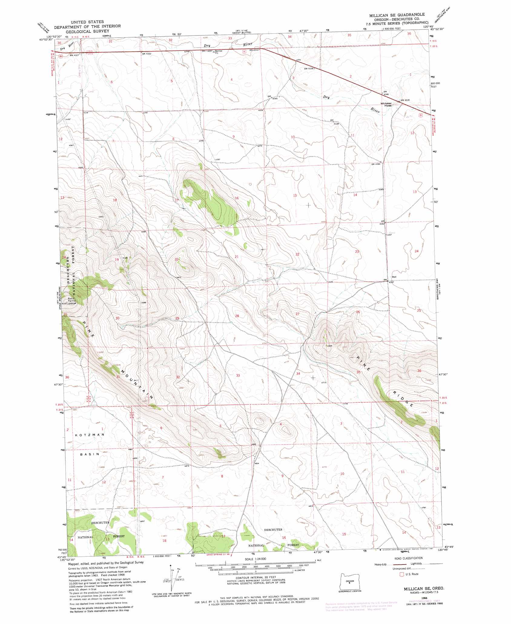
USGS Topo Quad 43120g7 - 1:24,000 scale
| Topo Map Name: | Millican Se |
| USGS Topo Quad ID: | 43120g7 |
| Print Size: | ca. 21 1/4" wide x 27" high |
| Southeast Coordinates: | 43.75° N latitude / 120.75° W longitude |
| Map Center Coordinates: | 43.8125° N latitude / 120.8125° W longitude |
| U.S. State: | OR |
| Filename: | o43120g7.jpg |
| Download Map JPG Image: | Millican Se topo map 1:24,000 scale |
| Map Type: | Topographic |
| Topo Series: | 7.5´ |
| Map Scale: | 1:24,000 |
| Source of Map Images: | United States Geological Survey (USGS) |
| Alternate Map Versions: |
Millican SE OR 1966, updated 1969 Download PDF Buy paper map Millican SE OR 1966, updated 1981 Download PDF Buy paper map Millican SE OR 2011 Download PDF Buy paper map Millican SE OR 2014 Download PDF Buy paper map |
| FStopo: | US Forest Service topo Millican SE is available: Download FStopo PDF Download FStopo TIF |
1:24,000 Topo Quads surrounding Millican Se
Alfalfa |
Horse Butte |
Bowman Dam |
Alkali Flat |
Conant Basin |
Horse Ridge |
Millican |
West Butte |
Rodman Ridge |
Sugarloaf Butte |
Evans Well |
Pine Mountain |
Millican Se |
Brothers Sw |
Brothers |
China Hat |
Firestone Butte |
Plot Butte |
Dickerson Flat |
Soldiers Gap |
South Ice Cave |
Sixteen Butte |
Fox Butte |
Walker Butte |
Last Chance Lake |
> Back to 43120e1 at 1:100,000 scale
> Back to 43120a1 at 1:250,000 scale
> Back to U.S. Topo Maps home
Millican Se topo map: Gazetteer
Millican Se: Basins
Kotzman Basin elevation 1470m 4822′Whitaker Holes elevation 1318m 4324′
Millican Se: Ridges
Pine Ridge elevation 1611m 5285′Millican Se digital topo map on disk
Buy this Millican Se topo map showing relief, roads, GPS coordinates and other geographical features, as a high-resolution digital map file on DVD: