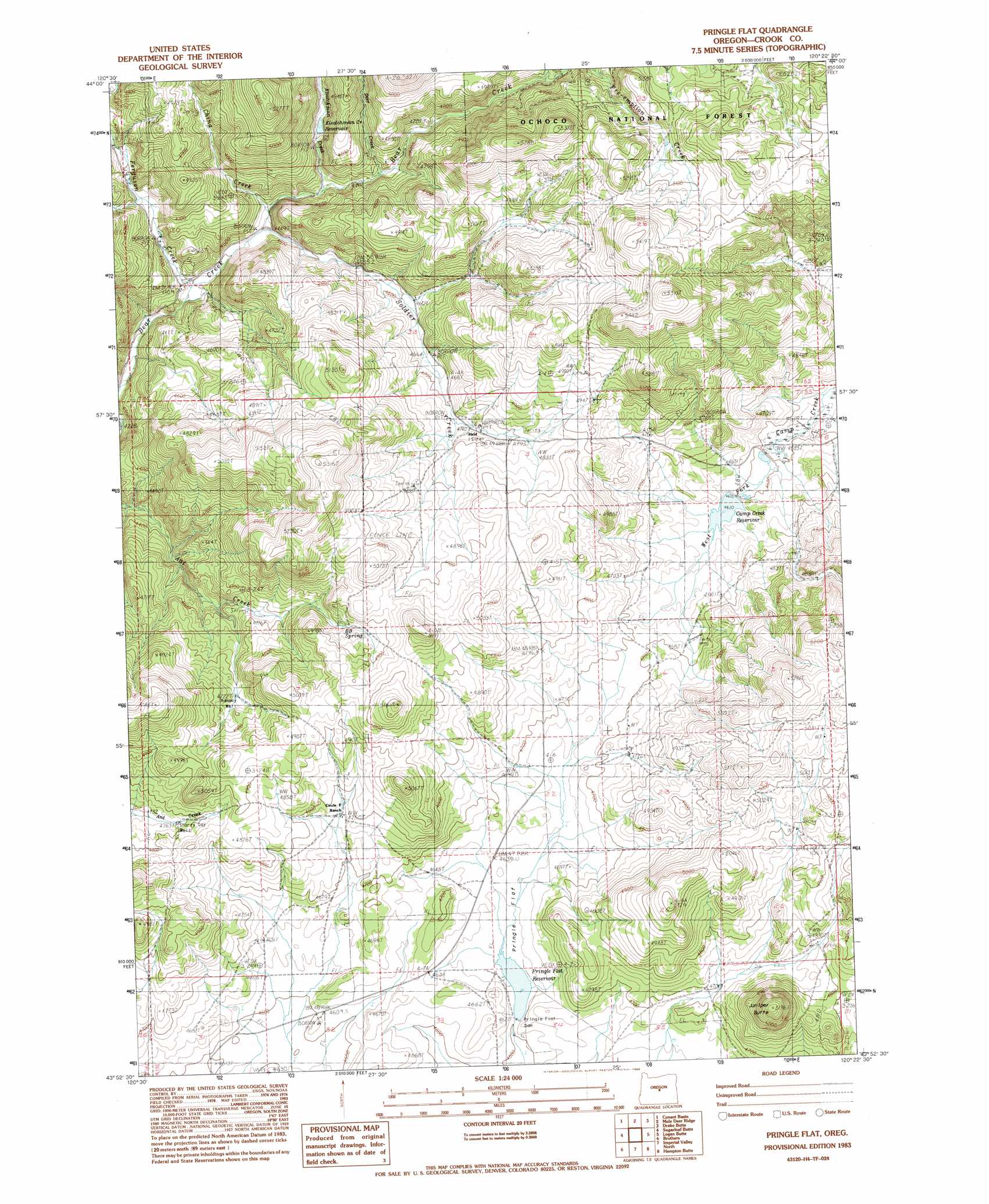
Pringle Flat Topo Map Oregon
To zoom in, hover over the map of Pringle Flat
USGS Topo Quad 43120h4 - 1:24,000 scale
| Topo Map Name: | Pringle Flat |
| USGS Topo Quad ID: | 43120h4 |
| Print Size: | ca. 21 1/4" wide x 27" high |
| Southeast Coordinates: | 43.875° N latitude / 120.375° W longitude |
| Map Center Coordinates: | 43.9375° N latitude / 120.4375° W longitude |
| U.S. State: | OR |
| Filename: | o43120h4.jpg |
| Download Map JPG Image: | Pringle Flat topo map 1:24,000 scale |
| Map Type: | Topographic |
| Topo Series: | 7.5´ |
| Map Scale: | 1:24,000 |
| Source of Map Images: | United States Geological Survey (USGS) |
| Alternate Map Versions: |
Pringle Flat OR 1983, updated 1983 Download PDF Buy paper map Pringle Flat OR 1992, updated 1997 Download PDF Buy paper map Pringle Flat OR 2011 Download PDF Buy paper map Pringle Flat OR 2014 Download PDF Buy paper map |
| FStopo: | US Forest Service topo Pringle Flat is available: Download FStopo PDF Download FStopo TIF |
1:24,000 Topo Quads surrounding Pringle Flat
Eagle Rock |
Pilot Butte |
Post |
Prairie Hill |
Committee Creek |
Alkali Flat |
Conant Basin |
Mule Deer Ridge |
Drake Butte |
Arrowwood Point |
Rodman Ridge |
Sugarloaf Butte |
Pringle Flat |
Logan Butte |
Gerry Mountain |
Brothers Sw |
Brothers |
Imperial Valley North |
Hampton Butte |
Long Barn |
Dickerson Flat |
Soldiers Gap |
Imperial Valley South |
West Of Hampston |
Hampton |
> Back to 43120e1 at 1:100,000 scale
> Back to 43120a1 at 1:250,000 scale
> Back to U.S. Topo Maps home
Pringle Flat topo map: Gazetteer
Pringle Flat: Dams
Camp Creek Dam elevation 1403m 4603′Klootchman Creek Dam elevation 1413m 4635′
Pringle Flat Dam elevation 1415m 4642′
Rickmans Camp Creek Number 2 Dam elevation 1408m 4619′
Pringle Flat: Post Offices
Held Post Office (historical) elevation 1453m 4767′Pringle Flat: Reservoirs
Klootchman Creek Reservoir elevation 1413m 4635′Pringle Flat Reservoir elevation 1415m 4642′
Rickmans Camp Creek Reservoir Number Two elevation 1408m 4619′
Pringle Flat: Streams
Deer Creek elevation 1484m 4868′Ferguson Creek elevation 1406m 4612′
Friday Creek elevation 1452m 4763′
Klootchman Creek elevation 1448m 4750′
Soldier Creek elevation 1410m 4625′
Pringle Flat digital topo map on disk
Buy this Pringle Flat topo map showing relief, roads, GPS coordinates and other geographical features, as a high-resolution digital map file on DVD: