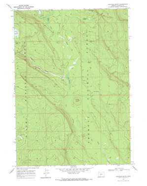
Location Butte Topo Map Oregon
To zoom in, hover over the map of Location Butte
USGS Topo Quad 43121b4 - 1:24,000 scale
| Topo Map Name: | Location Butte |
| USGS Topo Quad ID: | 43121b4 |
| Print Size: | ca. 21 1/4" wide x 27" high |
| Southeast Coordinates: | 43.125° N latitude / 121.375° W longitude |
| Map Center Coordinates: | 43.1875° N latitude / 121.4375° W longitude |
| U.S. State: | OR |
| Filename: | o43121b4.jpg |
| Download Map JPG Image: | Location Butte topo map 1:24,000 scale |
| Map Type: | Topographic |
| Topo Series: | 7.5´ |
| Map Scale: | 1:24,000 |
| Source of Map Images: | United States Geological Survey (USGS) |
| Alternate Map Versions: |
Location Butte OR 1968, updated 1971 Download PDF Buy paper map Location Butte OR 1999, updated 2002 Download PDF Buy paper map Location Butte OR 2011 Download PDF Buy paper map Location Butte OR 2014 Download PDF Buy paper map |
| FStopo: | US Forest Service topo Location Butte is available: Download FStopo PDF Download FStopo TIF |
1:24,000 Topo Quads surrounding Location Butte
> Back to 43121a1 at 1:100,000 scale
> Back to 43120a1 at 1:250,000 scale
> Back to U.S. Topo Maps home
Location Butte topo map: Gazetteer
Location Butte: Flats
Sagebrush Flat elevation 1516m 4973′Location Butte: Reservoirs
Cliff Spring Reservoir elevation 1591m 5219′Location Butte: Springs
Bull Jack Spring elevation 1530m 5019′Cliff Spring elevation 1592m 5223′
Dicks Camp Spring elevation 1541m 5055′
Mud Spring elevation 1533m 5029′
Section 9 Spring elevation 1542m 5059′
Location Butte: Summits
Location Butte elevation 1550m 5085′Location Butte: Swamps
Bear Wallow elevation 1516m 4973′Parker Meadow elevation 1608m 5275′
Location Butte: Valleys
Bear Flat Draw elevation 1516m 4973′Sagebrush Draw elevation 1516m 4973′
Location Butte: Wells
Nelson Well elevation 1524m 5000′Location Butte digital topo map on disk
Buy this Location Butte topo map showing relief, roads, GPS coordinates and other geographical features, as a high-resolution digital map file on DVD:


