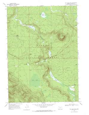
Tea Table Mountain Topo Map Oregon
To zoom in, hover over the map of Tea Table Mountain
USGS Topo Quad 43121b5 - 1:24,000 scale
| Topo Map Name: | Tea Table Mountain |
| USGS Topo Quad ID: | 43121b5 |
| Print Size: | ca. 21 1/4" wide x 27" high |
| Southeast Coordinates: | 43.125° N latitude / 121.5° W longitude |
| Map Center Coordinates: | 43.1875° N latitude / 121.5625° W longitude |
| U.S. State: | OR |
| Filename: | o43121b5.jpg |
| Download Map JPG Image: | Tea Table Mountain topo map 1:24,000 scale |
| Map Type: | Topographic |
| Topo Series: | 7.5´ |
| Map Scale: | 1:24,000 |
| Source of Map Images: | United States Geological Survey (USGS) |
| Alternate Map Versions: |
Tea Table Mtn OR 1968, updated 1972 Download PDF Buy paper map Tea Table Mountain OR 1999, updated 2002 Download PDF Buy paper map Tea Table Mountain OR 2011 Download PDF Buy paper map Tea Table Mountain OR 2014 Download PDF Buy paper map |
| FStopo: | US Forest Service topo Tea Table Mountain is available: Download FStopo PDF Download FStopo TIF |
1:24,000 Topo Quads surrounding Tea Table Mountain
> Back to 43121a1 at 1:100,000 scale
> Back to 43120a1 at 1:250,000 scale
> Back to U.S. Topo Maps home
Tea Table Mountain topo map: Gazetteer
Tea Table Mountain: Areas
The Rhubarb Patch elevation 1583m 5193′Tea Table Mountain: Flats
Mosquito Flat elevation 1563m 5127′Tea Table Mountain: Lakes
Table Lake elevation 1750m 5741′Tea Table Mountain: Springs
Bullfrog Spring elevation 1500m 4921′Cabin Spring elevation 1564m 5131′
Cleary Spring elevation 1532m 5026′
Dempsey Spring elevation 1605m 5265′
Huckleberry Spring elevation 1595m 5232′
Yellow Jacket Spring elevation 1530m 5019′
Tea Table Mountain: Summits
Tea Table Mountain elevation 1754m 5754′Tea Table Mountain: Swamps
Davis Flat elevation 1534m 5032′Hidden Meadow elevation 1535m 5036′
Jackies Thicket elevation 1564m 5131′
Jamison Meadow elevation 1602m 5255′
Little Round Meadow elevation 1568m 5144′
Lower Davis Flat elevation 1527m 5009′
O'Conner Meadow elevation 1500m 4921′
Stimson Meadow elevation 1652m 5419′
Tea Table Mountain digital topo map on disk
Buy this Tea Table Mountain topo map showing relief, roads, GPS coordinates and other geographical features, as a high-resolution digital map file on DVD:


