Fort Rock Topo Map Oregon
To zoom in, hover over the map of Fort Rock
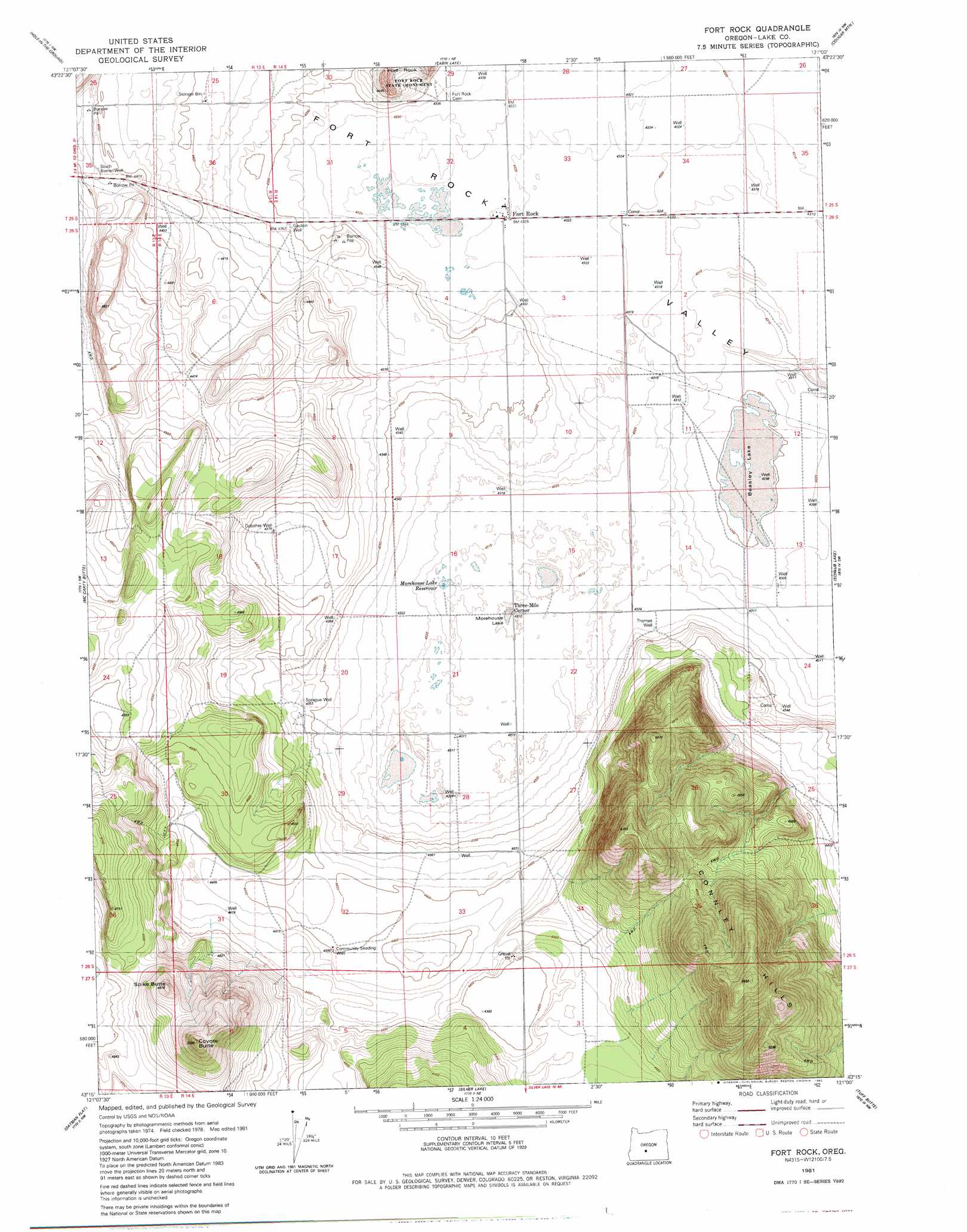
USGS Topo Quad 43121c1 - 1:24,000 scale
| Topo Map Name: | Fort Rock |
| USGS Topo Quad ID: | 43121c1 |
| Print Size: | ca. 21 1/4" wide x 27" high |
| Southeast Coordinates: | 43.25° N latitude / 121° W longitude |
| Map Center Coordinates: | 43.3125° N latitude / 121.0625° W longitude |
| U.S. State: | OR |
| Filename: | o43121c1.jpg |
| Download Map JPG Image: | Fort Rock topo map 1:24,000 scale |
| Map Type: | Topographic |
| Topo Series: | 7.5´ |
| Map Scale: | 1:24,000 |
| Source of Map Images: | United States Geological Survey (USGS) |
| Alternate Map Versions: |
Fort Rock OR 1981, updated 1982 Download PDF Buy paper map Fort Rock OR 2011 Download PDF Buy paper map Fort Rock OR 2014 Download PDF Buy paper map |
1:24,000 Topo Quads surrounding Fort Rock
Spring Butte |
Indian Butte |
South Ice Cave |
Sixteen Butte |
Fox Butte |
Big Hole |
Hole In The Ground |
Cabin Lake |
Cougar Mountain |
Hogback Butte |
Wickiup Spring |
Mccarty Butte |
Fort Rock |
Schaub Lake |
Lane Lake |
Antelope Mountain |
Oatman Flat |
Silver Lake |
Tuff Butte |
Thorn Lake |
Rodman Rock |
Bridge Creek Draw |
Hager Mountain |
Duncan Reservoir |
Egli Rim |
> Back to 43121a1 at 1:100,000 scale
> Back to 43120a1 at 1:250,000 scale
> Back to U.S. Topo Maps home
Fort Rock topo map: Gazetteer
Fort Rock: Flats
Morehouse Lake elevation 1309m 4294′Fort Rock: Lakes
Beasley Lake elevation 1311m 4301′Fort Rock: Parks
Fort Rock State Park elevation 1341m 4399′Fort Rock: Populated Places
Fort Rock elevation 1320m 4330′Fort Rock: Post Offices
Fort Rock Post Office elevation 1320m 4330′Fort Rock: Ranges
Connley Hills elevation 1606m 5269′Fort Rock: Reservoirs
Morehouse Lake Reservoir elevation 1315m 4314′Fort Rock: Summits
Coyote Butte elevation 1525m 5003′Spike Butte elevation 1480m 4855′
Fort Rock: Wells
Community Seeding Well elevation 1342m 4402′Gauldin Well elevation 1328m 4356′
Gubser Well elevation 1336m 4383′
South Beeler Well elevation 1362m 4468′
Sprague Well elevation 1330m 4363′
Thomas Well elevation 1321m 4333′
Fort Rock digital topo map on disk
Buy this Fort Rock topo map showing relief, roads, GPS coordinates and other geographical features, as a high-resolution digital map file on DVD: