Crescent Ne Topo Map Oregon
To zoom in, hover over the map of Crescent Ne
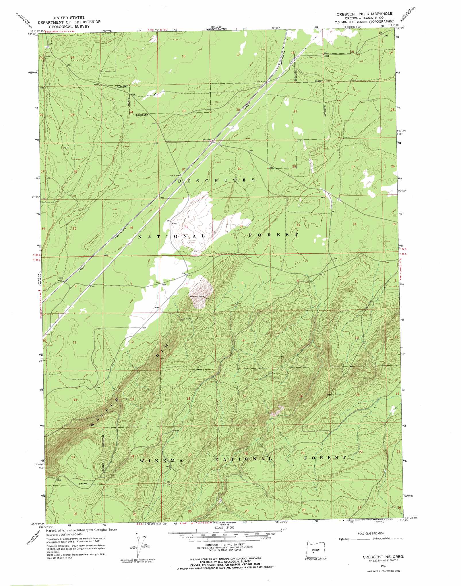
USGS Topo Quad 43121d5 - 1:24,000 scale
| Topo Map Name: | Crescent Ne |
| USGS Topo Quad ID: | 43121d5 |
| Print Size: | ca. 21 1/4" wide x 27" high |
| Southeast Coordinates: | 43.375° N latitude / 121.5° W longitude |
| Map Center Coordinates: | 43.4375° N latitude / 121.5625° W longitude |
| U.S. State: | OR |
| Filename: | o43121d5.jpg |
| Download Map JPG Image: | Crescent Ne topo map 1:24,000 scale |
| Map Type: | Topographic |
| Topo Series: | 7.5´ |
| Map Scale: | 1:24,000 |
| Source of Map Images: | United States Geological Survey (USGS) |
| Alternate Map Versions: |
Crescent NE OR 1967, updated 1971 Download PDF Buy paper map Crescent NE OR 1999, updated 2002 Download PDF Buy paper map Crescent NE OR 2011 Download PDF Buy paper map Crescent NE OR 2014 Download PDF Buy paper map |
| FStopo: | US Forest Service topo Crescent NE is available: Download FStopo PDF Download FStopo TIF |
1:24,000 Topo Quads surrounding Crescent Ne
Davis Mountain |
Wickiup Dam |
La Pine |
Finley Butte |
Paulina Peak |
Hamner Butte |
Cryder Butte |
Masten Butte |
Moffitt Butte |
Spring Butte |
Odell Butte |
Crescent |
Crescent Ne |
Grass Well |
Big Hole |
Muttonchop Butte |
Walker Mountain |
Sellers Marsh |
Stams Mountain |
Wickiup Spring |
Chemult |
Sugarpine Mountain Nw |
Tea Table Mountain |
Location Butte |
Antelope Mountain |
> Back to 43121a1 at 1:100,000 scale
> Back to 43120a1 at 1:250,000 scale
> Back to U.S. Topo Maps home
No gazetteer data is available for the Crescent Ne topo map sheet.
Crescent Ne digital topo map on disk
Buy this Crescent Ne topo map showing relief, roads, GPS coordinates and other geographical features, as a high-resolution digital map file on DVD: