Odell Butte Topo Map Oregon
To zoom in, hover over the map of Odell Butte
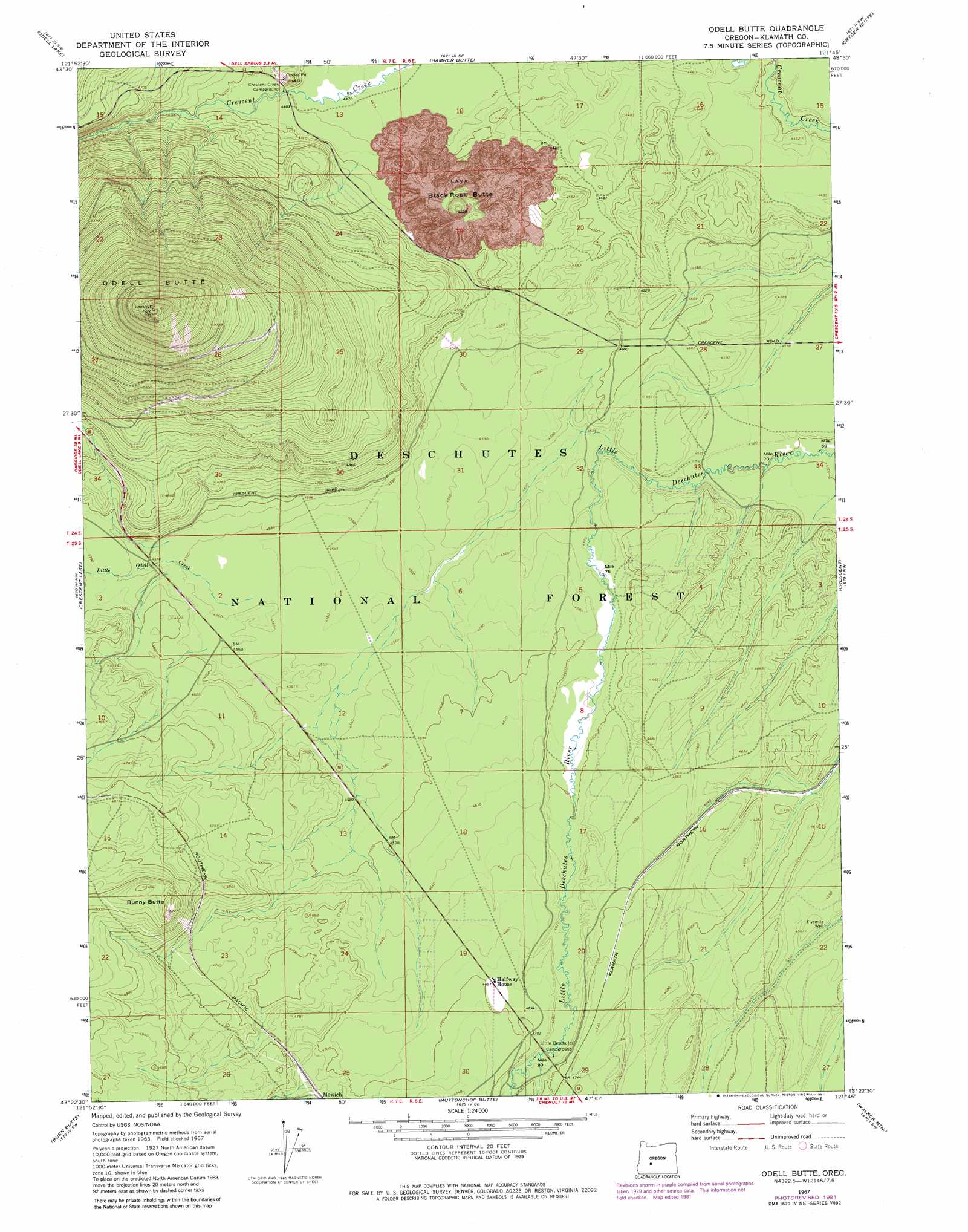
USGS Topo Quad 43121d7 - 1:24,000 scale
| Topo Map Name: | Odell Butte |
| USGS Topo Quad ID: | 43121d7 |
| Print Size: | ca. 21 1/4" wide x 27" high |
| Southeast Coordinates: | 43.375° N latitude / 121.75° W longitude |
| Map Center Coordinates: | 43.4375° N latitude / 121.8125° W longitude |
| U.S. State: | OR |
| Filename: | o43121d7.jpg |
| Download Map JPG Image: | Odell Butte topo map 1:24,000 scale |
| Map Type: | Topographic |
| Topo Series: | 7.5´ |
| Map Scale: | 1:24,000 |
| Source of Map Images: | United States Geological Survey (USGS) |
| Alternate Map Versions: |
Odell Butte OR 1967, updated 1971 Download PDF Buy paper map Odell Butte OR 1967, updated 1981 Download PDF Buy paper map Odell Butte OR 2011 Download PDF Buy paper map Odell Butte OR 2014 Download PDF Buy paper map |
| FStopo: | US Forest Service topo Odell Butte is available: Download FStopo PDF Download FStopo TIF |
1:24,000 Topo Quads surrounding Odell Butte
Waldo Lake |
The Twins |
Davis Mountain |
Wickiup Dam |
La Pine |
Willamette Pass |
Odell Lake |
Hamner Butte |
Cryder Butte |
Masten Butte |
Cowhorn Mountain |
Crescent Lake |
Odell Butte |
Crescent |
Crescent Ne |
Tolo Mountain |
Burn Butte |
Muttonchop Butte |
Walker Mountain |
Sellers Marsh |
Mount Thielsen |
Miller Lake |
Chemult |
Sugarpine Mountain Nw |
Tea Table Mountain |
> Back to 43121a1 at 1:100,000 scale
> Back to 43120a1 at 1:250,000 scale
> Back to U.S. Topo Maps home
Odell Butte topo map: Gazetteer
Odell Butte: Parks
Little Deschutes Campground (historical) elevation 1421m 4662′Odell Butte: Streams
Little Odell Creek elevation 1390m 4560′Odell Butte: Summits
Black Rock Butte elevation 1485m 4872′Bunny Butte elevation 1568m 5144′
Odell Butte elevation 2130m 6988′
Odell Butte: Wells
Fivemile Well elevation 1376m 4514′Odell Butte digital topo map on disk
Buy this Odell Butte topo map showing relief, roads, GPS coordinates and other geographical features, as a high-resolution digital map file on DVD: