Moffitt Butte Topo Map Oregon
To zoom in, hover over the map of Moffitt Butte
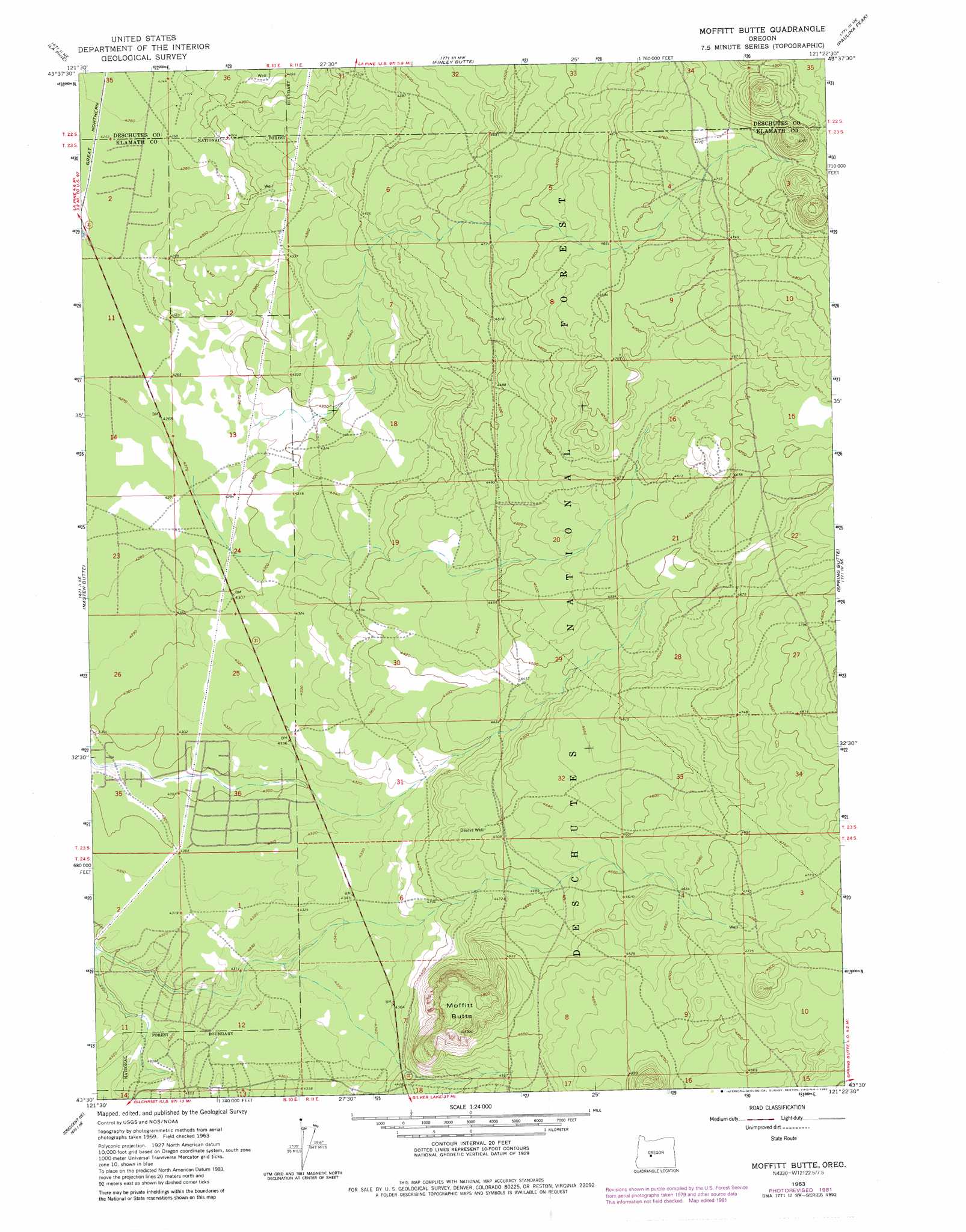
USGS Topo Quad 43121e4 - 1:24,000 scale
| Topo Map Name: | Moffitt Butte |
| USGS Topo Quad ID: | 43121e4 |
| Print Size: | ca. 21 1/4" wide x 27" high |
| Southeast Coordinates: | 43.5° N latitude / 121.375° W longitude |
| Map Center Coordinates: | 43.5625° N latitude / 121.4375° W longitude |
| U.S. State: | OR |
| Filename: | o43121e4.jpg |
| Download Map JPG Image: | Moffitt Butte topo map 1:24,000 scale |
| Map Type: | Topographic |
| Topo Series: | 7.5´ |
| Map Scale: | 1:24,000 |
| Source of Map Images: | United States Geological Survey (USGS) |
| Alternate Map Versions: |
Moffitt Butte OR 1963, updated 1965 Download PDF Buy paper map Moffitt Butte OR 1963, updated 1982 Download PDF Buy paper map Moffitt Butte OR 2011 Download PDF Buy paper map Moffitt Butte OR 2014 Download PDF Buy paper map |
| FStopo: | US Forest Service topo Moffitt Butte is available: Download FStopo PDF Download FStopo TIF |
1:24,000 Topo Quads surrounding Moffitt Butte
Round Mountain |
Pistol Butte |
Anns Butte |
Lava Cast Forest |
Fuzztail Butte |
Wickiup Dam |
La Pine |
Finley Butte |
Paulina Peak |
East Lake |
Cryder Butte |
Masten Butte |
Moffitt Butte |
Spring Butte |
Indian Butte |
Crescent |
Crescent Ne |
Grass Well |
Big Hole |
Hole In The Ground |
Walker Mountain |
Sellers Marsh |
Stams Mountain |
Wickiup Spring |
Mccarty Butte |
> Back to 43121e1 at 1:100,000 scale
> Back to 43120a1 at 1:250,000 scale
> Back to U.S. Topo Maps home
Moffitt Butte topo map: Gazetteer
Moffitt Butte: Summits
Moffitt Butte elevation 1477m 4845′Moffitt Butte: Wells
Dealys Well elevation 1371m 4498′Moffitt Butte digital topo map on disk
Buy this Moffitt Butte topo map showing relief, roads, GPS coordinates and other geographical features, as a high-resolution digital map file on DVD: