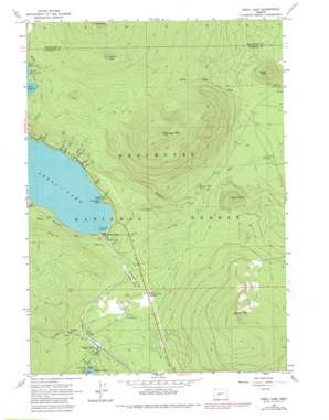
Odell Lake Topo Map Oregon
To zoom in, hover over the map of Odell Lake
USGS Topo Quad 43121e8 - 1:24,000 scale
| Topo Map Name: | Odell Lake |
| USGS Topo Quad ID: | 43121e8 |
| Print Size: | ca. 21 1/4" wide x 27" high |
| Southeast Coordinates: | 43.5° N latitude / 121.875° W longitude |
| Map Center Coordinates: | 43.5625° N latitude / 121.9375° W longitude |
| U.S. State: | OR |
| Filename: | o43121e8.jpg |
| Download Map JPG Image: | Odell Lake topo map 1:24,000 scale |
| Map Type: | Topographic |
| Topo Series: | 7.5´ |
| Map Scale: | 1:24,000 |
| Source of Map Images: | United States Geological Survey (USGS) |
| Alternate Map Versions: |
Odell Lake OR 1963, updated 1965 Download PDF Buy paper map Odell Lake OR 1963, updated 1975 Download PDF Buy paper map Odell Lake OR 1967, updated 1981 Download PDF Buy paper map Odell Lake OR 2011 Download PDF Buy paper map Odell Lake OR 2014 Download PDF Buy paper map |
| FStopo: | US Forest Service topo Odell Lake is available: Download FStopo PDF Download FStopo TIF |
1:24,000 Topo Quads surrounding Odell Lake
> Back to 43121e1 at 1:100,000 scale
> Back to 43120a1 at 1:250,000 scale
> Back to U.S. Topo Maps home
Odell Lake topo map: Gazetteer
Odell Lake: Airports
Crescent Lake State Airport elevation 1464m 4803′Odell Lake: Bays
Sunset Cove elevation 1462m 4796′Odell Lake: Capes
Chinquapin Point elevation 1483m 4865′Odell Lake: Dams
Crescent Lake Dam elevation 1490m 4888′Odell Lake: Lakes
Lower Rosary Lake elevation 1740m 5708′Maiden Lake elevation 1948m 6391′
Odell Lake elevation 1460m 4790′
Odell Lake: Populated Places
Odell Lake elevation 1468m 4816′Odell Lake: Post Offices
Crescent Lake Post Office elevation 1462m 4796′Odell Lake: Springs
Cold Spring elevation 1452m 4763′McCord Cabin Spring elevation 1415m 4642′
Odell Lake: Streams
Alder Creek elevation 1464m 4803′Antler Creek elevation 1460m 4790′
Cold Spring Creek elevation 1440m 4724′
Douglas Creek elevation 1460m 4790′
Fire Creek elevation 1460m 4790′
Johnston Creek elevation 1443m 4734′
Little Creek elevation 1460m 4790′
Mafler Creek elevation 1460m 4790′
Maklaks Creek elevation 1395m 4576′
No-See-Em Creek elevation 1460m 4790′
Orphan Creek elevation 1460m 4790′
Quita Creek elevation 1460m 4790′
Resort Creek elevation 1447m 4747′
Rhodod Creek elevation 1460m 4790′
Solomon Creek elevation 1460m 4790′
Thunder Creek elevation 1460m 4790′
Triple Creek elevation 1461m 4793′
Wharf Creek elevation 1460m 4790′
Odell Lake: Summits
Maklaks Mountain elevation 2111m 6925′McCool Butte elevation 1577m 5173′
Ranger Butte elevation 1538m 5045′
Royce Mountain elevation 1870m 6135′
Odell Lake: Trails
Crater Butte Trail elevation 1598m 5242′Fawn Lake Trail elevation 1643m 5390′
Pretty Lake Trail elevation 1655m 5429′
Odell Lake digital topo map on disk
Buy this Odell Lake topo map showing relief, roads, GPS coordinates and other geographical features, as a high-resolution digital map file on DVD:


