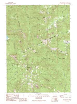
Fish Mountain Topo Map Oregon
To zoom in, hover over the map of Fish Mountain
USGS Topo Quad 43122a4 - 1:24,000 scale
| Topo Map Name: | Fish Mountain |
| USGS Topo Quad ID: | 43122a4 |
| Print Size: | ca. 21 1/4" wide x 27" high |
| Southeast Coordinates: | 43° N latitude / 122.375° W longitude |
| Map Center Coordinates: | 43.0625° N latitude / 122.4375° W longitude |
| U.S. State: | OR |
| Filename: | o43122a4.jpg |
| Download Map JPG Image: | Fish Mountain topo map 1:24,000 scale |
| Map Type: | Topographic |
| Topo Series: | 7.5´ |
| Map Scale: | 1:24,000 |
| Source of Map Images: | United States Geological Survey (USGS) |
| Alternate Map Versions: |
Fish Mountain OR 1989, updated 1990 Download PDF Buy paper map Fish Mountain OR 2011 Download PDF Buy paper map Fish Mountain OR 2014 Download PDF Buy paper map |
| FStopo: | US Forest Service topo Fish Mountain is available: Download FStopo PDF Download FStopo TIF |
1:24,000 Topo Quads surrounding Fish Mountain
> Back to 43122a1 at 1:100,000 scale
> Back to 43122a1 at 1:250,000 scale
> Back to U.S. Topo Maps home
Fish Mountain topo map: Gazetteer
Fish Mountain: Basins
Hole in the Ground elevation 1613m 5291′Fish Mountain: Cliffs
Devils Slide elevation 1812m 5944′Fish Mountain: Flats
Alkali Meadows elevation 1713m 5620′Foster Glades elevation 1515m 4970′
High Prairie elevation 1805m 5921′
Pup Prairie elevation 1688m 5538′
Fish Mountain: Gaps
Windy Gap elevation 1678m 5505′Fish Mountain: Lakes
Mosquito Lake elevation 1765m 5790′Poole Lake elevation 1350m 4429′
Toad Lake elevation 1495m 4904′
Triangle Lake elevation 1391m 4563′
Fish Mountain: Parks
Alkali Camp elevation 1683m 5521′Lewis Camp elevation 1710m 5610′
Wiley Camp elevation 1454m 4770′
Fish Mountain: Pillars
Castle Rock elevation 1717m 5633′Fish Mountain: Ridges
Rocky Ridge elevation 1842m 6043′Fish Mountain: Streams
Gale Creek elevation 1029m 3375′Highrock Creek elevation 1028m 3372′
Horse Creek elevation 1083m 3553′
Hummingbird Creek elevation 1172m 3845′
Hunter Creek elevation 1256m 4120′
Log Creek elevation 1258m 4127′
Slide Creek elevation 1071m 3513′
Wiley Creek elevation 1158m 3799′
Fish Mountain: Summits
Fish Mountain elevation 2055m 6742′Hershberger Mountain elevation 1908m 6259′
Highrock Mountain elevation 1867m 6125′
Jackass Mountain elevation 1878m 6161′
Rabbit Ears elevation 1794m 5885′
Rattlesnake Mountain elevation 2027m 6650′
Weaver Mountain elevation 1916m 6286′
Fish Mountain: Trails
Buck Canyon Trail elevation 1440m 4724′Fish Lake Trail elevation 1548m 5078′
Log Pile Trail elevation 1815m 5954′
Meadow Creek Trail elevation 1583m 5193′
Fish Mountain: Valleys
Fish Creek Valley elevation 1405m 4609′Fish Mountain digital topo map on disk
Buy this Fish Mountain topo map showing relief, roads, GPS coordinates and other geographical features, as a high-resolution digital map file on DVD:


