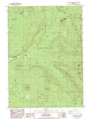
Tolo Mountain Topo Map Oregon
To zoom in, hover over the map of Tolo Mountain
USGS Topo Quad 43122c1 - 1:24,000 scale
| Topo Map Name: | Tolo Mountain |
| USGS Topo Quad ID: | 43122c1 |
| Print Size: | ca. 21 1/4" wide x 27" high |
| Southeast Coordinates: | 43.25° N latitude / 122° W longitude |
| Map Center Coordinates: | 43.3125° N latitude / 122.0625° W longitude |
| U.S. State: | OR |
| Filename: | o43122c1.jpg |
| Download Map JPG Image: | Tolo Mountain topo map 1:24,000 scale |
| Map Type: | Topographic |
| Topo Series: | 7.5´ |
| Map Scale: | 1:24,000 |
| Source of Map Images: | United States Geological Survey (USGS) |
| Alternate Map Versions: |
Tolo Mountain OR 1986, updated 1986 Download PDF Buy paper map Tolo Mountain OR 1998, updated 2000 Download PDF Buy paper map Tolo Mountain OR 2011 Download PDF Buy paper map Tolo Mountain OR 2014 Download PDF Buy paper map |
| FStopo: | US Forest Service topo Tolo Mountain is available: Download FStopo PDF Download FStopo TIF |
1:24,000 Topo Quads surrounding Tolo Mountain
> Back to 43122a1 at 1:100,000 scale
> Back to 43122a1 at 1:250,000 scale
> Back to U.S. Topo Maps home
Tolo Mountain topo map: Gazetteer
Tolo Mountain: Flats
Slim Prairie elevation 1546m 5072′Tolo Mountain: Gaps
Windigo Pass elevation 1778m 5833′Tolo Mountain: Lakes
Calamut Lake elevation 1797m 5895′Lake Charline elevation 1742m 5715′
Lake Lucile elevation 1816m 5958′
Linda Lake elevation 1757m 5764′
Maidu Lake elevation 1824m 5984′
Windigo Lakes elevation 1794m 5885′
Tolo Mountain: Streams
Bradley Creek elevation 1306m 4284′Tolo Creek elevation 1379m 4524′
Warrior Creek elevation 1347m 4419′
Tolo Mountain: Summits
Kelsay Point elevation 1500m 4921′Mule Peak elevation 2087m 6847′
Red Cinder Butte elevation 1993m 6538′
Tenas Peak elevation 1992m 6535′
Thirsty Point elevation 1813m 5948′
Tolo Mountain elevation 2143m 7030′
Windigo Butte elevation 1948m 6391′
Tolo Mountain: Trails
Calamut Way elevation 1767m 5797′Kelsay Way elevation 1591m 5219′
Maidu Lake Way elevation 1460m 4790′
Tolo Mountain digital topo map on disk
Buy this Tolo Mountain topo map showing relief, roads, GPS coordinates and other geographical features, as a high-resolution digital map file on DVD:


