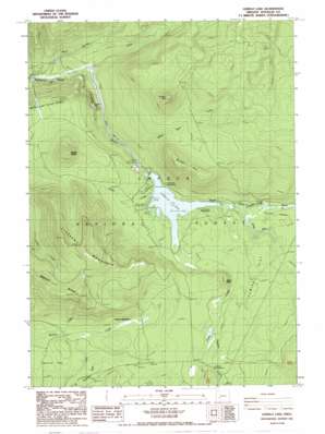
Lemolo Lake Topo Map Oregon
To zoom in, hover over the map of Lemolo Lake
USGS Topo Quad 43122c2 - 1:24,000 scale
| Topo Map Name: | Lemolo Lake |
| USGS Topo Quad ID: | 43122c2 |
| Print Size: | ca. 21 1/4" wide x 27" high |
| Southeast Coordinates: | 43.25° N latitude / 122.125° W longitude |
| Map Center Coordinates: | 43.3125° N latitude / 122.1875° W longitude |
| U.S. State: | OR |
| Filename: | o43122c2.jpg |
| Download Map JPG Image: | Lemolo Lake topo map 1:24,000 scale |
| Map Type: | Topographic |
| Topo Series: | 7.5´ |
| Map Scale: | 1:24,000 |
| Source of Map Images: | United States Geological Survey (USGS) |
| Alternate Map Versions: |
Lemolo Lake OR 1986, updated 1986 Download PDF Buy paper map Lemolo Lake OR 1998, updated 2000 Download PDF Buy paper map Lemolo Lake OR 2011 Download PDF Buy paper map Lemolo Lake OR 2014 Download PDF Buy paper map |
| FStopo: | US Forest Service topo Lemolo Lake is available: Download FStopo PDF Download FStopo TIF |
1:24,000 Topo Quads surrounding Lemolo Lake
> Back to 43122a1 at 1:100,000 scale
> Back to 43122a1 at 1:250,000 scale
> Back to U.S. Topo Maps home
Lemolo Lake topo map: Gazetteer
Lemolo Lake: Canals
Lemolo Canal Number 1 elevation 1261m 4137′Lemolo Lake: Dams
Lemolo Number 1 Dam elevation 1251m 4104′Lemolo Number 2 Forebay Dam elevation 1277m 4189′
Lemolo Lake: Falls
Lemolo Falls elevation 1140m 3740′Lemolo Lake: Flats
Pumice Flat elevation 1324m 4343′Toolbox Meadows elevation 1431m 4694′
Lemolo Lake: Reservoirs
Lemolo Lake elevation 1251m 4104′Lemolo Number 2 Forebay elevation 1277m 4189′
Lemolo Lake: Springs
Crystal Springs elevation 1280m 4199′Lemolo Lake: Streams
Crystal Creek elevation 1286m 4219′Lake Creek elevation 1267m 4156′
Poole Creek elevation 1264m 4146′
Spring River elevation 1267m 4156′
Thielsen Creek elevation 1335m 4379′
Thirsty Creek elevation 1301m 4268′
Warm Spring Creek elevation 1017m 3336′
White Mule Creek elevation 1234m 4048′
Lemolo Lake: Summits
Basket Butte elevation 1608m 5275′Bunker Hill elevation 1688m 5538′
Elbow Butte elevation 1420m 4658′
Elephant Mountain elevation 1808m 5931′
Kelsay Mountain elevation 1821m 5974′
Lemolo Lake: Trails
Windigo Way elevation 1741m 5711′Lemolo Lake: Valleys
Kelsay Valley elevation 1264m 4146′Lemolo Lake digital topo map on disk
Buy this Lemolo Lake topo map showing relief, roads, GPS coordinates and other geographical features, as a high-resolution digital map file on DVD:


