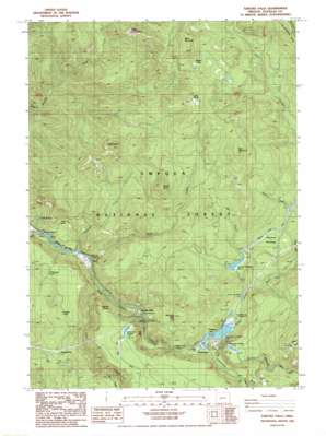
Toketee Falls Topo Map Oregon
To zoom in, hover over the map of Toketee Falls
USGS Topo Quad 43122c4 - 1:24,000 scale
| Topo Map Name: | Toketee Falls |
| USGS Topo Quad ID: | 43122c4 |
| Print Size: | ca. 21 1/4" wide x 27" high |
| Southeast Coordinates: | 43.25° N latitude / 122.375° W longitude |
| Map Center Coordinates: | 43.3125° N latitude / 122.4375° W longitude |
| U.S. State: | OR |
| Filename: | o43122c4.jpg |
| Download Map JPG Image: | Toketee Falls topo map 1:24,000 scale |
| Map Type: | Topographic |
| Topo Series: | 7.5´ |
| Map Scale: | 1:24,000 |
| Source of Map Images: | United States Geological Survey (USGS) |
| Alternate Map Versions: |
Toketee Falls OR 1986, updated 1986 Download PDF Buy paper map Toketee Falls OR 1997, updated 2000 Download PDF Buy paper map Toketee Falls OR 2011 Download PDF Buy paper map Toketee Falls OR 2014 Download PDF Buy paper map |
| FStopo: | US Forest Service topo Toketee Falls is available: Download FStopo PDF Download FStopo TIF |
1:24,000 Topo Quads surrounding Toketee Falls
> Back to 43122a1 at 1:100,000 scale
> Back to 43122a1 at 1:250,000 scale
> Back to U.S. Topo Maps home
Toketee Falls topo map: Gazetteer
Toketee Falls: Areas
Cinder Prairie elevation 1631m 5351′Toketee Falls: Cliffs
Flatiron Point elevation 885m 2903′Toketee Falls: Dams
Slide Creek Dam elevation 625m 2050′Soda Springs Dam elevation 539m 1768′
Toketee Dam elevation 848m 2782′
Toketee Falls: Falls
Toketee Falls elevation 749m 2457′Toketee Falls: Flats
Bridge Prairie elevation 758m 2486′Mountain Meadows elevation 940m 3083′
Toketee Falls: Lakes
Skipper Lakes elevation 1562m 5124′Toketee Falls: Pillars
Deer Leap Rock elevation 1022m 3353′Silver Rock elevation 1438m 4717′
Toketee Falls: Populated Places
Clearwater elevation 742m 2434′Toketee Falls elevation 639m 2096′
Toketee Falls: Post Offices
Toketee Falls Post Office (historical) elevation 639m 2096′Toketee Falls: Reservoirs
Fish Creek Forebay elevation 922m 3024′Lemolo Forebay elevation 971m 3185′
Ringtail Pond elevation 932m 3057′
Slide Creek Reservoir elevation 625m 2050′
Soda Springs Reservoir elevation 539m 1768′
Toketee Lake elevation 848m 2782′
Toketee Falls: Springs
Soda Springs elevation 596m 1955′Toketee Falls: Streams
Clearwater River elevation 746m 2447′Deer Creek elevation 1034m 3392′
Fish Creek elevation 572m 1876′
Medicine Creek elevation 552m 1811′
Mill Creek elevation 789m 2588′
Pie Creek elevation 710m 2329′
Slide Creek elevation 558m 1830′
Spring Creek elevation 755m 2477′
Thorn Creek elevation 1007m 3303′
Watson Creek elevation 794m 2604′
Toketee Falls: Summits
Camel Hump elevation 1383m 4537′Perry Butte elevation 1476m 4842′
Thorn Mountain elevation 1604m 5262′
Toketee Falls: Trails
Boulder Creek Trail elevation 1229m 4032′Bradley Trail elevation 1061m 3480′
Cinder Prairie Way elevation 1293m 4242′
Mountain Meadows Trail elevation 1370m 4494′
Perry Butte Way elevation 1240m 4068′
Toketee Falls: Woods
Ringtail Pine elevation 969m 3179′Toketee Falls digital topo map on disk
Buy this Toketee Falls topo map showing relief, roads, GPS coordinates and other geographical features, as a high-resolution digital map file on DVD:


