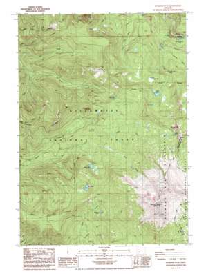
Diamond Peak Topo Map Oregon
To zoom in, hover over the map of Diamond Peak
USGS Topo Quad 43122e2 - 1:24,000 scale
| Topo Map Name: | Diamond Peak |
| USGS Topo Quad ID: | 43122e2 |
| Print Size: | ca. 21 1/4" wide x 27" high |
| Southeast Coordinates: | 43.5° N latitude / 122.125° W longitude |
| Map Center Coordinates: | 43.5625° N latitude / 122.1875° W longitude |
| U.S. State: | OR |
| Filename: | o43122e2.jpg |
| Download Map JPG Image: | Diamond Peak topo map 1:24,000 scale |
| Map Type: | Topographic |
| Topo Series: | 7.5´ |
| Map Scale: | 1:24,000 |
| Source of Map Images: | United States Geological Survey (USGS) |
| Alternate Map Versions: |
Diamond Peak OR 1986, updated 1986 Download PDF Buy paper map Diamond Peak OR 1997, updated 1998 Download PDF Buy paper map Diamond Peak OR 2011 Download PDF Buy paper map Diamond Peak OR 2014 Download PDF Buy paper map |
| FStopo: | US Forest Service topo Diamond Peak is available: Download FStopo PDF Download FStopo TIF |
1:24,000 Topo Quads surrounding Diamond Peak
> Back to 43122e1 at 1:100,000 scale
> Back to 43122a1 at 1:250,000 scale
> Back to U.S. Topo Maps home
Diamond Peak topo map: Gazetteer
Diamond Peak: Falls
Fall Creek Falls elevation 1466m 4809′Salt Creek Falls elevation 1207m 3959′
Diamond Peak: Flats
Wolf Prairie elevation 1783m 5849′Diamond Peak: Lakes
Blue Lake elevation 1643m 5390′Corrigan Lake elevation 1693m 5554′
Happy Lake elevation 1607m 5272′
Lopez Lake elevation 1557m 5108′
Notch Lake elevation 1671m 5482′
Too Much Bear Lake elevation 1256m 4120′
Vivian Lake elevation 1776m 5826′
Diamond Peak: Streams
Bear Creek elevation 1062m 3484′Bect Creek elevation 1240m 4068′
Diamond Creek elevation 1118m 3667′
Fall Creek elevation 1323m 4340′
Pinto Creek elevation 1057m 3467′
Scout Creek elevation 1363m 4471′
Diamond Peak: Summits
Bear Mountain elevation 1843m 6046′Devils Garden elevation 1570m 5150′
Diamond Peak elevation 2644m 8674′
Hemlock Butte elevation 1740m 5708′
Judd Mountain elevation 1822m 5977′
Moss Mountain elevation 1812m 5944′
Mount Yoran elevation 2155m 7070′
Pinto Mountain elevation 1918m 6292′
Wolf Mountain elevation 1959m 6427′
Diamond Peak: Trails
Diamond Peak Trail elevation 1760m 5774′Hills Creek Trail elevation 1213m 3979′
Pinto Mountain Way elevation 1739m 5705′
Wolf Mountain Trail elevation 1717m 5633′
Diamond Peak digital topo map on disk
Buy this Diamond Peak topo map showing relief, roads, GPS coordinates and other geographical features, as a high-resolution digital map file on DVD:


