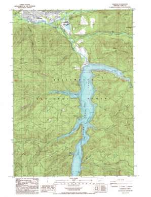
Oakridge Topo Map Oregon
To zoom in, hover over the map of Oakridge
USGS Topo Quad 43122f4 - 1:24,000 scale
| Topo Map Name: | Oakridge |
| USGS Topo Quad ID: | 43122f4 |
| Print Size: | ca. 21 1/4" wide x 27" high |
| Southeast Coordinates: | 43.625° N latitude / 122.375° W longitude |
| Map Center Coordinates: | 43.6875° N latitude / 122.4375° W longitude |
| U.S. State: | OR |
| Filename: | o43122f4.jpg |
| Download Map JPG Image: | Oakridge topo map 1:24,000 scale |
| Map Type: | Topographic |
| Topo Series: | 7.5´ |
| Map Scale: | 1:24,000 |
| Source of Map Images: | United States Geological Survey (USGS) |
| Alternate Map Versions: |
Oakridge OR 1997, updated 1998 Download PDF Buy paper map Oakridge OR 2011 Download PDF Buy paper map Oakridge OR 2014 Download PDF Buy paper map |
| FStopo: | US Forest Service topo Oakridge is available: Download FStopo PDF Download FStopo TIF |
1:24,000 Topo Quads surrounding Oakridge
> Back to 43122e1 at 1:100,000 scale
> Back to 43122a1 at 1:250,000 scale
> Back to U.S. Topo Maps home
Oakridge topo map: Gazetteer
Oakridge: Airports
Prospect State Airport elevation 338m 1108′Oakridge: Bays
Larison Cove elevation 471m 1545′Stony Cove elevation 466m 1528′
Oakridge: Dams
Hills Creek Dam elevation 467m 1532′Ornoname 17 Dam elevation 393m 1289′
Oakridge: Parks
Greenwaters Park elevation 358m 1174′Salmon Creek Park elevation 364m 1194′
Oakridge: Pillars
Baby Rock elevation 826m 2709′Larison Rock elevation 1096m 3595′
Oakridge: Populated Places
Oakridge elevation 372m 1220′Willamette City elevation 342m 1122′
Oakridge: Post Offices
Oakridge Post Office elevation 372m 1220′Tiptop Post Office (historical) elevation 488m 1601′
West Oak Post Office (historical) elevation 351m 1151′
Oakridge: Reservoirs
Hills Creek Lake elevation 467m 1532′Oakridge: Streams
Big Willow Creek elevation 471m 1545′Bull Creek elevation 471m 1545′
Flat Creek elevation 391m 1282′
Hills Creek elevation 471m 1545′
Larison Creek elevation 471m 1545′
Little Willow Creek elevation 471m 1545′
Modoc Creek elevation 471m 1545′
Packard Creek elevation 471m 1545′
Salmon Creek elevation 354m 1161′
Salt Creek elevation 373m 1223′
Shortridge Creek elevation 339m 1112′
Stony Creek elevation 471m 1545′
Tumble Creek elevation 458m 1502′
Way Creek elevation 471m 1545′
Oakridge: Summits
Aubrey Mountain elevation 922m 3024′Bald Butte elevation 1041m 3415′
T V Butte elevation 547m 1794′
Tufti Mountain elevation 955m 3133′
Oakridge digital topo map on disk
Buy this Oakridge topo map showing relief, roads, GPS coordinates and other geographical features, as a high-resolution digital map file on DVD:


