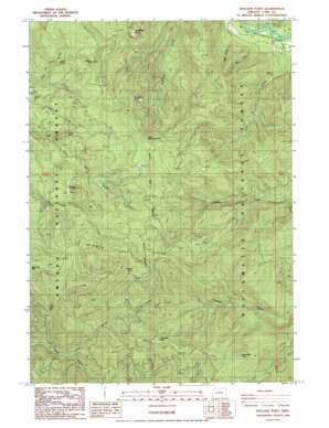
Holland Point Topo Map Oregon
To zoom in, hover over the map of Holland Point
USGS Topo Quad 43122f5 - 1:24,000 scale
| Topo Map Name: | Holland Point |
| USGS Topo Quad ID: | 43122f5 |
| Print Size: | ca. 21 1/4" wide x 27" high |
| Southeast Coordinates: | 43.625° N latitude / 122.5° W longitude |
| Map Center Coordinates: | 43.6875° N latitude / 122.5625° W longitude |
| U.S. State: | OR |
| Filename: | o43122f5.jpg |
| Download Map JPG Image: | Holland Point topo map 1:24,000 scale |
| Map Type: | Topographic |
| Topo Series: | 7.5´ |
| Map Scale: | 1:24,000 |
| Source of Map Images: | United States Geological Survey (USGS) |
| Alternate Map Versions: |
Holland Point OR 1986, updated 1987 Download PDF Buy paper map Holland Point OR 2011 Download PDF Buy paper map Holland Point OR 2014 Download PDF Buy paper map |
| FStopo: | US Forest Service topo Holland Point is available: Download FStopo PDF Download FStopo TIF |
1:24,000 Topo Quads surrounding Holland Point
> Back to 43122e1 at 1:100,000 scale
> Back to 43122a1 at 1:250,000 scale
> Back to U.S. Topo Maps home
Holland Point topo map: Gazetteer
Holland Point: Bridges
Barnard Bridge elevation 324m 1062′Holland Point: Falls
Lower Parker Falls elevation 814m 2670′Moonfalls elevation 925m 3034′
Pinard Falls elevation 761m 2496′
Upper Parker Falls elevation 840m 2755′
Holland Point: Flats
Holland Meadows elevation 1481m 4858′Holland Point: Pillars
Little Deception Rock elevation 1398m 4586′Holland Point: Post Offices
Hill Post Office (historical) elevation 1085m 3559′Holland Point: Ridges
Dinner Ridge elevation 1455m 4773′Holland Point: Streams
Chilly Creek elevation 356m 1167′Gray Creek elevation 330m 1082′
Parker Creek elevation 762m 2500′
Spot Creek elevation 337m 1105′
Wyatt Creek elevation 716m 2349′
Holland Point: Summits
Deception Butte elevation 1083m 3553′Deception Rock elevation 1267m 4156′
Fivepoint Hill elevation 1146m 3759′
Holland Point elevation 1527m 5009′
McFarland Point elevation 1344m 4409′
Pinard Butte elevation 1039m 3408′
Sugarloaf Mountain elevation 1377m 4517′
Swastika Mountain elevation 1191m 3907′
Timbered Knoll elevation 1491m 4891′
Holland Point: Trails
Dinner Ridge Way elevation 1141m 3743′Holland Meadows Trail elevation 1356m 4448′
Larison Creek Trail elevation 1029m 3375′
Packard Creek Trail elevation 869m 2851′
Swastika Mountain Trail elevation 1159m 3802′
Willamette Divide Trail elevation 1140m 3740′
Holland Point digital topo map on disk
Buy this Holland Point topo map showing relief, roads, GPS coordinates and other geographical features, as a high-resolution digital map file on DVD:


