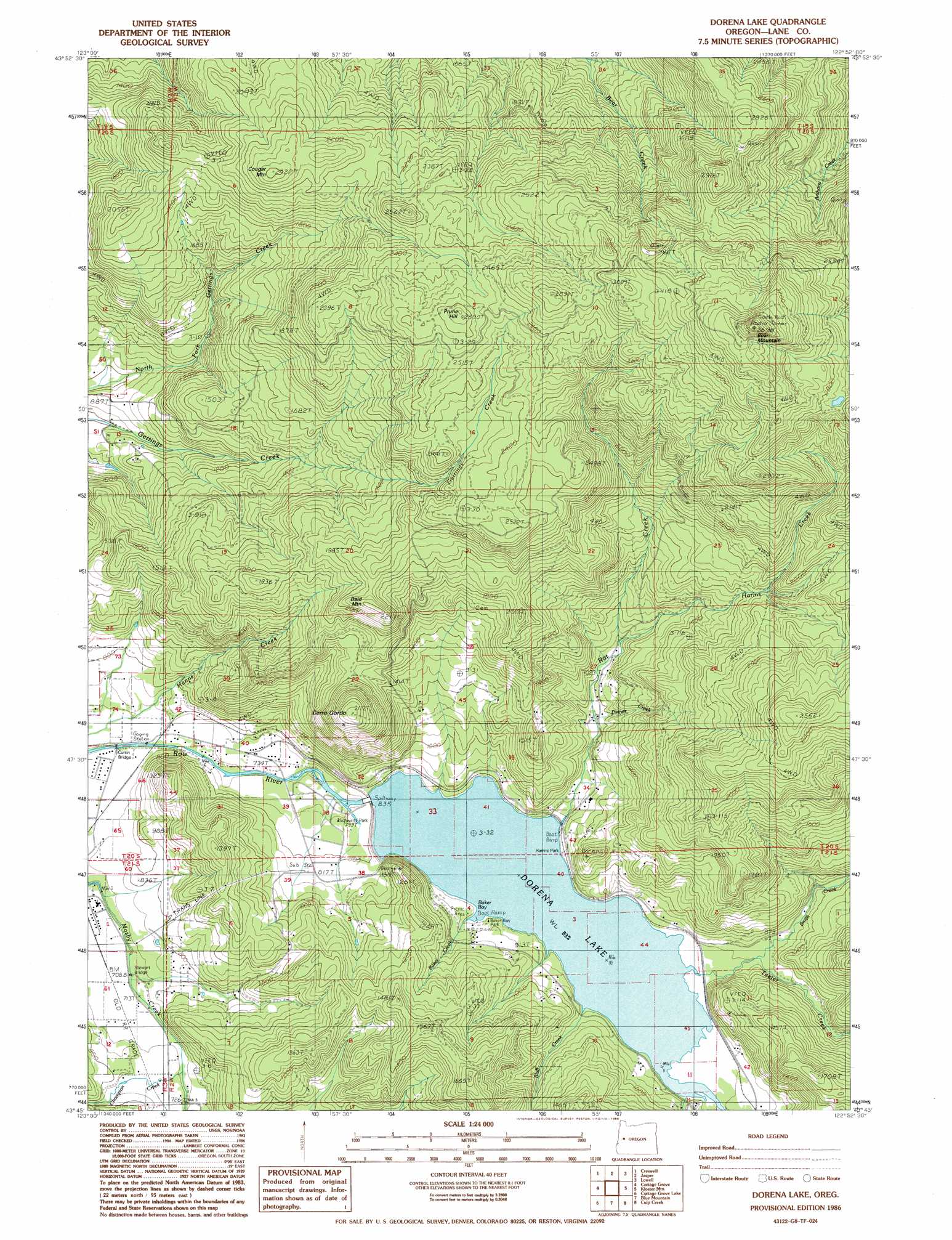
Dorena Lake Topo Map Oregon
To zoom in, hover over the map of Dorena Lake
USGS Topo Quad 43122g8 - 1:24,000 scale
| Topo Map Name: | Dorena Lake |
| USGS Topo Quad ID: | 43122g8 |
| Print Size: | ca. 21 1/4" wide x 27" high |
| Southeast Coordinates: | 43.75° N latitude / 122.875° W longitude |
| Map Center Coordinates: | 43.8125° N latitude / 122.9375° W longitude |
| U.S. State: | OR |
| Filename: | o43122g8.jpg |
| Download Map JPG Image: | Dorena Lake topo map 1:24,000 scale |
| Map Type: | Topographic |
| Topo Series: | 7.5´ |
| Map Scale: | 1:24,000 |
| Source of Map Images: | United States Geological Survey (USGS) |
| Alternate Map Versions: |
Dorena Lake OR 1986, updated 1988 Download PDF Buy paper map Dorena Lake OR 2011 Download PDF Buy paper map Dorena Lake OR 2014 Download PDF Buy paper map |
1:24,000 Topo Quads surrounding Dorena Lake
Eugene West |
Eugene East |
Springfield |
Walterville |
Leaburg |
Fox Hollow |
Creswell |
Jasper |
Lowell |
Fall Creek Lake |
Lorane |
Cottage Grove |
Dorena Lake |
Kloster Mountain |
Mount June |
Curtin |
Cottage Grove Lake |
Blue Mountain |
Culp Creek |
Rose Hill |
Scotts Valley |
Harness Mountain |
Burnt Mountain |
Silica Mountain |
Fairview Peak |
> Back to 43122e1 at 1:100,000 scale
> Back to 43122a1 at 1:250,000 scale
> Back to U.S. Topo Maps home
Dorena Lake topo map: Gazetteer
Dorena Lake: Areas
Teeter Creek Recreational Area elevation 255m 836′Dorena Lake: Bays
Baker Bay elevation 267m 875′Dorena Lake: Bridges
Currin Bridge elevation 482m 1581′Stewart Bridge elevation 854m 2801′
Dorena Lake: Dams
Dorena Dam elevation 255m 836′Dorena Lake: Parks
Baker Bay County Park elevation 275m 902′Harms Park elevation 255m 836′
Mount Pisgah Regional Park elevation 502m 1646′
Schwartz Park elevation 238m 780′
Dorena Lake: Populated Places
Dorena (historical) elevation 255m 836′Dorena Lake: Post Offices
Christman Post Office (historical) elevation 521m 1709′June Post Office (historical) elevation 656m 2152′
Dorena Lake: Reservoirs
Dorena Lake elevation 255m 836′Dorena Lake: Streams
Baker Creek elevation 265m 869′Bluff Creek elevation 255m 836′
Dinner Creek elevation 294m 964′
Hamblen Creek elevation 232m 761′
Hanns Creek elevation 218m 715′
Harms Creek elevation 337m 1105′
Rat Creek elevation 255m 836′
Smith Creek elevation 255m 836′
Teeter Creek elevation 259m 849′
Vaughn Creek elevation 255m 836′
Dorena Lake: Summits
Bald Mountain elevation 672m 2204′Bear Mountain elevation 1119m 3671′
Cerro Gordo elevation 639m 2096′
Cougar Mountain elevation 733m 2404′
Prune Hill elevation 811m 2660′
Dorena Lake digital topo map on disk
Buy this Dorena Lake topo map showing relief, roads, GPS coordinates and other geographical features, as a high-resolution digital map file on DVD: