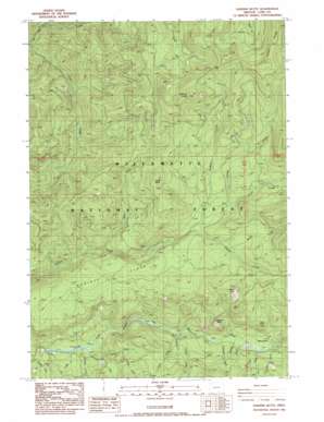
Sardine Butte Topo Map Oregon
To zoom in, hover over the map of Sardine Butte
USGS Topo Quad 43122h3 - 1:24,000 scale
| Topo Map Name: | Sardine Butte |
| USGS Topo Quad ID: | 43122h3 |
| Print Size: | ca. 21 1/4" wide x 27" high |
| Southeast Coordinates: | 43.875° N latitude / 122.25° W longitude |
| Map Center Coordinates: | 43.9375° N latitude / 122.3125° W longitude |
| U.S. State: | OR |
| Filename: | o43122h3.jpg |
| Download Map JPG Image: | Sardine Butte topo map 1:24,000 scale |
| Map Type: | Topographic |
| Topo Series: | 7.5´ |
| Map Scale: | 1:24,000 |
| Source of Map Images: | United States Geological Survey (USGS) |
| Alternate Map Versions: |
Sardine Butte OR 1986, updated 1986 Download PDF Buy paper map Sardine Butte OR 1997, updated 1998 Download PDF Buy paper map Sardine Butte OR 2011 Download PDF Buy paper map Sardine Butte OR 2014 Download PDF Buy paper map |
| FStopo: | US Forest Service topo Sardine Butte is available: Download FStopo PDF Download FStopo TIF |
1:24,000 Topo Quads surrounding Sardine Butte
> Back to 43122e1 at 1:100,000 scale
> Back to 43122a1 at 1:250,000 scale
> Back to U.S. Topo Maps home
Sardine Butte topo map: Gazetteer
Sardine Butte: Flats
Christy Flats elevation 930m 3051′Major Prairie elevation 678m 2224′
Sardine Butte: Springs
Salt Springs elevation 922m 3024′Sardine Butte: Streams
Buzzard Creek elevation 635m 2083′Cedar Creek elevation 635m 2083′
Coffee Creek elevation 581m 1906′
Evergreen Creek elevation 656m 2152′
Grassy Creek elevation 921m 3021′
Lefty Creek elevation 1043m 3421′
Lowell Creek elevation 922m 3024′
Major Creek elevation 669m 2194′
Maple Creek elevation 660m 2165′
Mill Creek elevation 706m 2316′
Mossy Creek elevation 957m 3139′
Nehi Creek elevation 793m 2601′
Parallel Creek elevation 652m 2139′
Parker Creek elevation 682m 2237′
Plateau Creek elevation 595m 1952′
Platt Creek elevation 608m 1994′
Roosevelt Creek elevation 643m 2109′
Sardine Creek elevation 907m 2975′
Shale Creek elevation 721m 2365′
Sidewalk Creek elevation 585m 1919′
Silver Creek elevation 666m 2185′
Steer Creek elevation 657m 2155′
Whiterock Creek elevation 594m 1948′
Sardine Butte: Summits
Battle Peak elevation 1170m 3838′Buffalo Peak elevation 984m 3228′
Ingram Butte elevation 1241m 4071′
Sardine Butte elevation 1537m 5042′
Sardine Butte: Valleys
Devils Canyon elevation 640m 2099′Sardine Butte digital topo map on disk
Buy this Sardine Butte topo map showing relief, roads, GPS coordinates and other geographical features, as a high-resolution digital map file on DVD:


