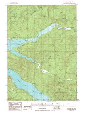
Fall Creek Lake Topo Map Oregon
To zoom in, hover over the map of Fall Creek Lake
USGS Topo Quad 43122h6 - 1:24,000 scale
| Topo Map Name: | Fall Creek Lake |
| USGS Topo Quad ID: | 43122h6 |
| Print Size: | ca. 21 1/4" wide x 27" high |
| Southeast Coordinates: | 43.875° N latitude / 122.625° W longitude |
| Map Center Coordinates: | 43.9375° N latitude / 122.6875° W longitude |
| U.S. State: | OR |
| Filename: | o43122h6.jpg |
| Download Map JPG Image: | Fall Creek Lake topo map 1:24,000 scale |
| Map Type: | Topographic |
| Topo Series: | 7.5´ |
| Map Scale: | 1:24,000 |
| Source of Map Images: | United States Geological Survey (USGS) |
| Alternate Map Versions: |
Fall Creek Lake OR 1986, updated 1986 Download PDF Buy paper map Fall Creek Lake OR 1997, updated 2001 Download PDF Buy paper map Fall Creek Lake OR 2011 Download PDF Buy paper map Fall Creek Lake OR 2014 Download PDF Buy paper map |
| FStopo: | US Forest Service topo Fall Creek Lake is available: Download FStopo PDF Download FStopo TIF |
1:24,000 Topo Quads surrounding Fall Creek Lake
> Back to 43122e1 at 1:100,000 scale
> Back to 43122a1 at 1:250,000 scale
> Back to U.S. Topo Maps home
Fall Creek Lake topo map: Gazetteer
Fall Creek Lake: Gaps
Wimble Pass elevation 430m 1410′Fall Creek Lake: Parks
Fall Creek Reservoir State Park elevation 256m 839′Landax Landing Park elevation 291m 954′
Fall Creek Lake: Populated Places
Winberry elevation 255m 836′Fall Creek Lake: Post Offices
Egypt Post Office (historical) elevation 258m 846′Winberry Post Office (historical) elevation 255m 836′
Fall Creek Lake: Streams
Alder Creek elevation 295m 967′Disgust Creek elevation 293m 961′
East Fork Minnow Creek elevation 296m 971′
Hyde Creek elevation 268m 879′
Little Gold Creek elevation 266m 872′
Minnow Creek elevation 284m 931′
Murphy Creek elevation 256m 839′
Nelson Creek elevation 256m 839′
North Fork Fall Creek elevation 266m 872′
Norton Creek elevation 281m 921′
Rolling Riffle Creek elevation 284m 931′
Timber Creek elevation 255m 836′
Winberry Creek elevation 257m 843′
Fall Creek Lake: Summits
Bear Mountain elevation 945m 3100′Deer Mountain elevation 732m 2401′
Fairview Mountain elevation 488m 1601′
Green Butte elevation 455m 1492′
Green Mountain elevation 659m 2162′
Greentop elevation 793m 2601′
Horn Butte elevation 514m 1686′
Mount Salem elevation 901m 2956′
Fall Creek Lake digital topo map on disk
Buy this Fall Creek Lake topo map showing relief, roads, GPS coordinates and other geographical features, as a high-resolution digital map file on DVD:


