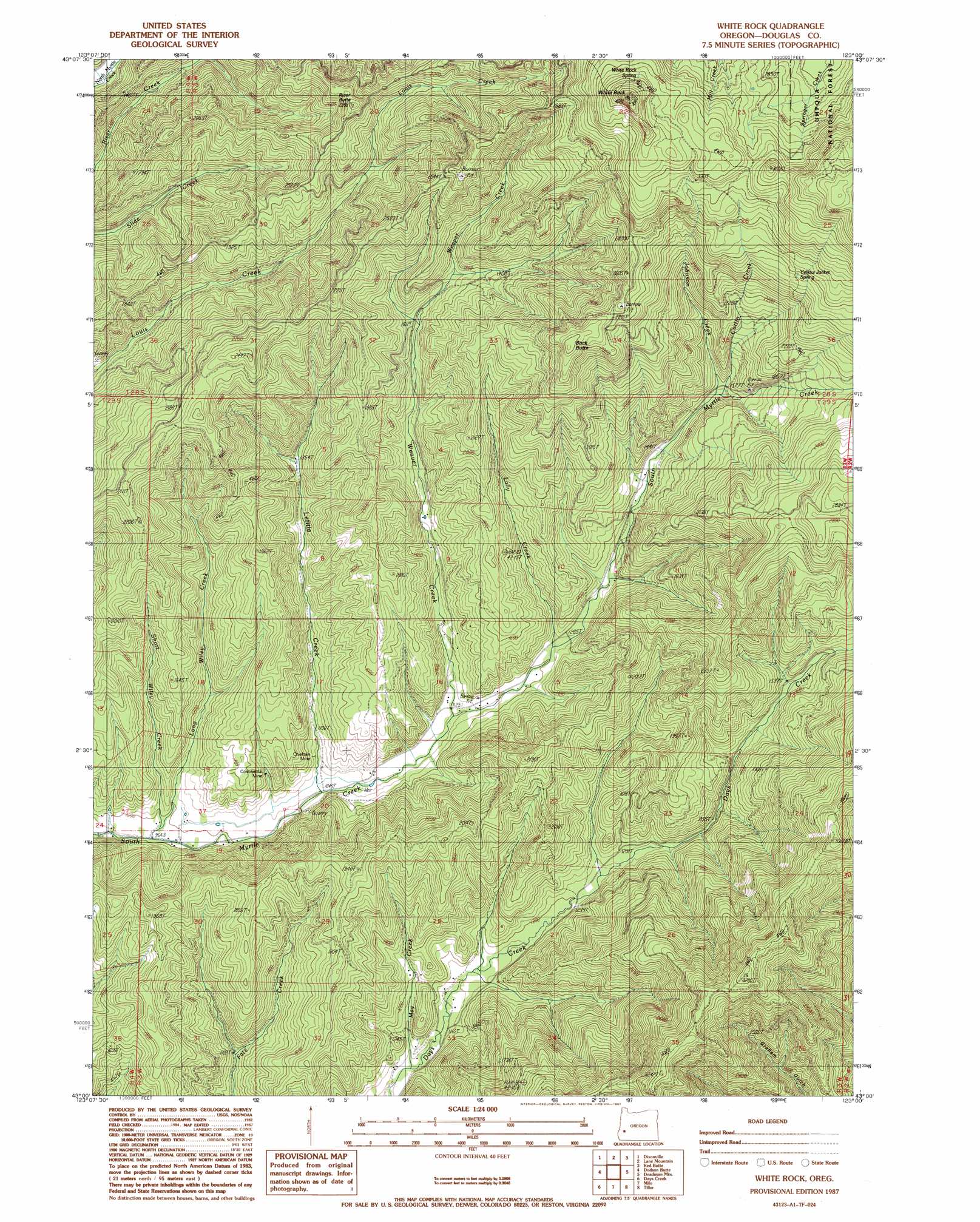
White Rock Topo Map Oregon
To zoom in, hover over the map of White Rock
USGS Topo Quad 43123a1 - 1:24,000 scale
| Topo Map Name: | White Rock |
| USGS Topo Quad ID: | 43123a1 |
| Print Size: | ca. 21 1/4" wide x 27" high |
| Southeast Coordinates: | 43° N latitude / 123° W longitude |
| Map Center Coordinates: | 43.0625° N latitude / 123.0625° W longitude |
| U.S. State: | OR |
| Filename: | o43123a1.jpg |
| Download Map JPG Image: | White Rock topo map 1:24,000 scale |
| Map Type: | Topographic |
| Topo Series: | 7.5´ |
| Map Scale: | 1:24,000 |
| Source of Map Images: | United States Geological Survey (USGS) |
| Alternate Map Versions: |
White Rock OR 1987, updated 1987 Download PDF Buy paper map White Rock OR 2011 Download PDF Buy paper map White Rock OR 2014 Download PDF Buy paper map |
| FStopo: | US Forest Service topo White Rock is available: Download FStopo PDF Download FStopo TIF |
1:24,000 Topo Quads surrounding White Rock
Winchester |
Oak Creek Valley |
Glide |
Old Fairview |
Mace Mountain |
Roseburg East |
Dixonville |
Lane Mountain |
Red Butte |
Taft Mountain |
Myrtle Creek |
Dodson Butte |
White Rock |
Deadman Mountain |
Dumont Creek |
Canyonville |
Days Creek |
Milo |
Tiller |
Pickett Butte |
Quines Creek |
Starvout Creek |
Cedar Springs Mountain |
Richter Mountain |
Ragsdale Butte |
> Back to 43123a1 at 1:100,000 scale
> Back to 43122a1 at 1:250,000 scale
> Back to U.S. Topo Maps home
White Rock topo map: Gazetteer
White Rock: Mines
Chieftain Mine elevation 343m 1125′Continental Mine elevation 378m 1240′
White Rock: Pillars
White Rock elevation 1208m 3963′White Rock: Populated Places
Nugget (historical) elevation 375m 1230′White Rock: Post Offices
Isolate Post Office (historical) elevation 365m 1197′Nugget Post Office (historical) elevation 375m 1230′
White Rock: Reservoirs
Briggs Reservoir elevation 330m 1082′White Rock: Springs
White Rock Springs elevation 1061m 3480′Yellow Jacket Spring elevation 819m 2687′
White Rock: Streams
Curtin Creek elevation 473m 1551′Johnson Creek elevation 473m 1551′
Lally Creek elevation 375m 1230′
Letitia Creek elevation 318m 1043′
Long Wiley Creek elevation 300m 984′
May Creek elevation 325m 1066′
Short Wiley Creek elevation 296m 971′
Weaver Creek elevation 342m 1122′
Wrights Creek elevation 329m 1079′
White Rock: Summits
Buck Butte elevation 914m 2998′Riser Butte elevation 720m 2362′
White Rock: Trails
White Rock Trail elevation 990m 3248′White Rock digital topo map on disk
Buy this White Rock topo map showing relief, roads, GPS coordinates and other geographical features, as a high-resolution digital map file on DVD: