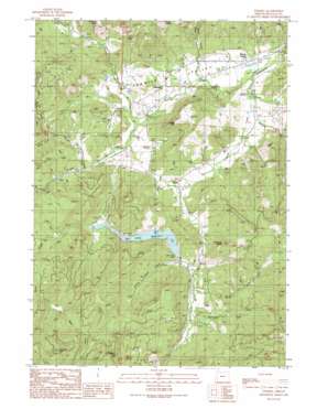
Tenmile Topo Map Oregon
To zoom in, hover over the map of Tenmile
USGS Topo Quad 43123a5 - 1:24,000 scale
| Topo Map Name: | Tenmile |
| USGS Topo Quad ID: | 43123a5 |
| Print Size: | ca. 21 1/4" wide x 27" high |
| Southeast Coordinates: | 43° N latitude / 123.5° W longitude |
| Map Center Coordinates: | 43.0625° N latitude / 123.5625° W longitude |
| U.S. State: | OR |
| Filename: | o43123a5.jpg |
| Download Map JPG Image: | Tenmile topo map 1:24,000 scale |
| Map Type: | Topographic |
| Topo Series: | 7.5´ |
| Map Scale: | 1:24,000 |
| Source of Map Images: | United States Geological Survey (USGS) |
| Alternate Map Versions: |
Tenmile OR 1990, updated 1990 Download PDF Buy paper map Tenmile OR 2011 Download PDF Buy paper map Tenmile OR 2014 Download PDF Buy paper map |
1:24,000 Topo Quads surrounding Tenmile
> Back to 43123a1 at 1:100,000 scale
> Back to 43122a1 at 1:250,000 scale
> Back to U.S. Topo Maps home
Tenmile topo map: Gazetteer
Tenmile: Areas
Tenmile Valley elevation 226m 741′Tenmile: Dams
Berry Creek Dam elevation 279m 915′Edward Wageman Dam elevation 251m 823′
Tenmile: Pillars
Chimney Rock elevation 697m 2286′Tenmile: Populated Places
Olalla elevation 248m 813′Porter Creek elevation 199m 652′
Tenmile elevation 208m 682′
Tenmile: Post Offices
Olalla Post Office (historical) elevation 248m 813′Tenmile Post Office elevation 208m 682′
Tenmile: Reservoirs
Berry Creek Reservoir elevation 279m 915′Cleveland Log Ponds elevation 194m 636′
Edward Wageman Reservoir elevation 251m 823′
Tenmile: Streams
Bear Creek elevation 330m 1082′Berry Creek elevation 234m 767′
Bushnell Creek elevation 240m 787′
Byron Creek elevation 239m 784′
Coarse Gold Creek elevation 241m 790′
Irwin Creek elevation 200m 656′
Little Muley Creek elevation 260m 853′
McNabb Creek elevation 196m 643′
Muns Creek elevation 260m 853′
North Fork Byron Creek elevation 294m 964′
Olalla Creek elevation 190m 623′
Perron Creek elevation 192m 629′
Porter Creek elevation 201m 659′
Shields Creek elevation 214m 702′
Suicide Creek elevation 234m 767′
Tenmile Creek elevation 189m 620′
Weaver Creek elevation 245m 803′
Tenmile: Summits
Dickerson Rocks elevation 495m 1624′Irwin Rocks elevation 642m 2106′
Mount Shep elevation 707m 2319′
Porter Hill elevation 527m 1729′
Tenmile: Valleys
Dickerson Canyon elevation 229m 751′Sibold Canyon elevation 218m 715′
Upper Olalla Valley elevation 245m 803′
Tenmile digital topo map on disk
Buy this Tenmile topo map showing relief, roads, GPS coordinates and other geographical features, as a high-resolution digital map file on DVD:


