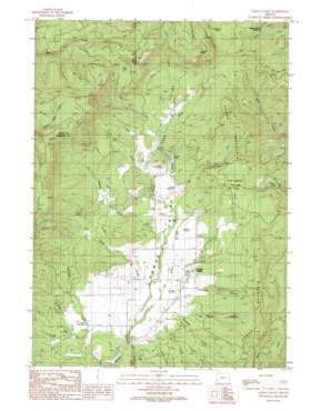
Camas Valley Topo Map Oregon
To zoom in, hover over the map of Camas Valley
USGS Topo Quad 43123a6 - 1:24,000 scale
| Topo Map Name: | Camas Valley |
| USGS Topo Quad ID: | 43123a6 |
| Print Size: | ca. 21 1/4" wide x 27" high |
| Southeast Coordinates: | 43° N latitude / 123.625° W longitude |
| Map Center Coordinates: | 43.0625° N latitude / 123.6875° W longitude |
| U.S. State: | OR |
| Filename: | o43123a6.jpg |
| Download Map JPG Image: | Camas Valley topo map 1:24,000 scale |
| Map Type: | Topographic |
| Topo Series: | 7.5´ |
| Map Scale: | 1:24,000 |
| Source of Map Images: | United States Geological Survey (USGS) |
| Alternate Map Versions: |
Camas Valley OR 1990, updated 1990 Download PDF Buy paper map Camas Valley OR 2011 Download PDF Buy paper map Camas Valley OR 2014 Download PDF Buy paper map |
1:24,000 Topo Quads surrounding Camas Valley
> Back to 43123a1 at 1:100,000 scale
> Back to 43122a1 at 1:250,000 scale
> Back to U.S. Topo Maps home
Camas Valley topo map: Gazetteer
Camas Valley: Dams
Kinnan Dam elevation 366m 1200′Rodger Iverson Dam elevation 309m 1013′
Camas Valley: Lakes
Lost Lake elevation 718m 2355′Camas Valley: Parks
Camas Mountain State Park (historical) elevation 446m 1463′Camas Valley: Populated Places
Camas Valley elevation 346m 1135′Camas Valley: Post Offices
Camas Valley Post Office elevation 346m 1135′Camas Valley: Reservoirs
Barnhart Reservoir elevation 327m 1072′Combs Reservoir elevation 326m 1069′
Denn Reservoir elevation 365m 1197′
Kinnan Reservoir elevation 366m 1200′
Rodger Iverson Reservoir elevation 309m 1013′
Thrush Reservoir elevation 333m 1092′
Turquoise Pond elevation 546m 1791′
Camas Valley: Ridges
Little Muley elevation 425m 1394′Camas Valley: Streams
Bar Creek elevation 336m 1102′Bingham Creek elevation 324m 1062′
Cole Creek elevation 345m 1131′
Day Creek elevation 319m 1046′
Deep Creek elevation 362m 1187′
Estes Creek elevation 382m 1253′
Holmes Creek elevation 318m 1043′
Jim Belieu Creek elevation 321m 1053′
Kirkendall Branch elevation 326m 1069′
Lake Creek elevation 373m 1223′
Long Creek elevation 349m 1145′
Mill Creek elevation 319m 1046′
Noah Creek elevation 322m 1056′
Reed Creek elevation 325m 1066′
Thompson Creek elevation 350m 1148′
Wildcat Creek elevation 342m 1122′
Camas Valley: Summits
Bennett Rock elevation 907m 2975′Camas Mountain elevation 586m 1922′
Camas Valley: Valleys
Camas Valley elevation 323m 1059′Tom Taylor Canyon elevation 362m 1187′
Camas Valley digital topo map on disk
Buy this Camas Valley topo map showing relief, roads, GPS coordinates and other geographical features, as a high-resolution digital map file on DVD:


