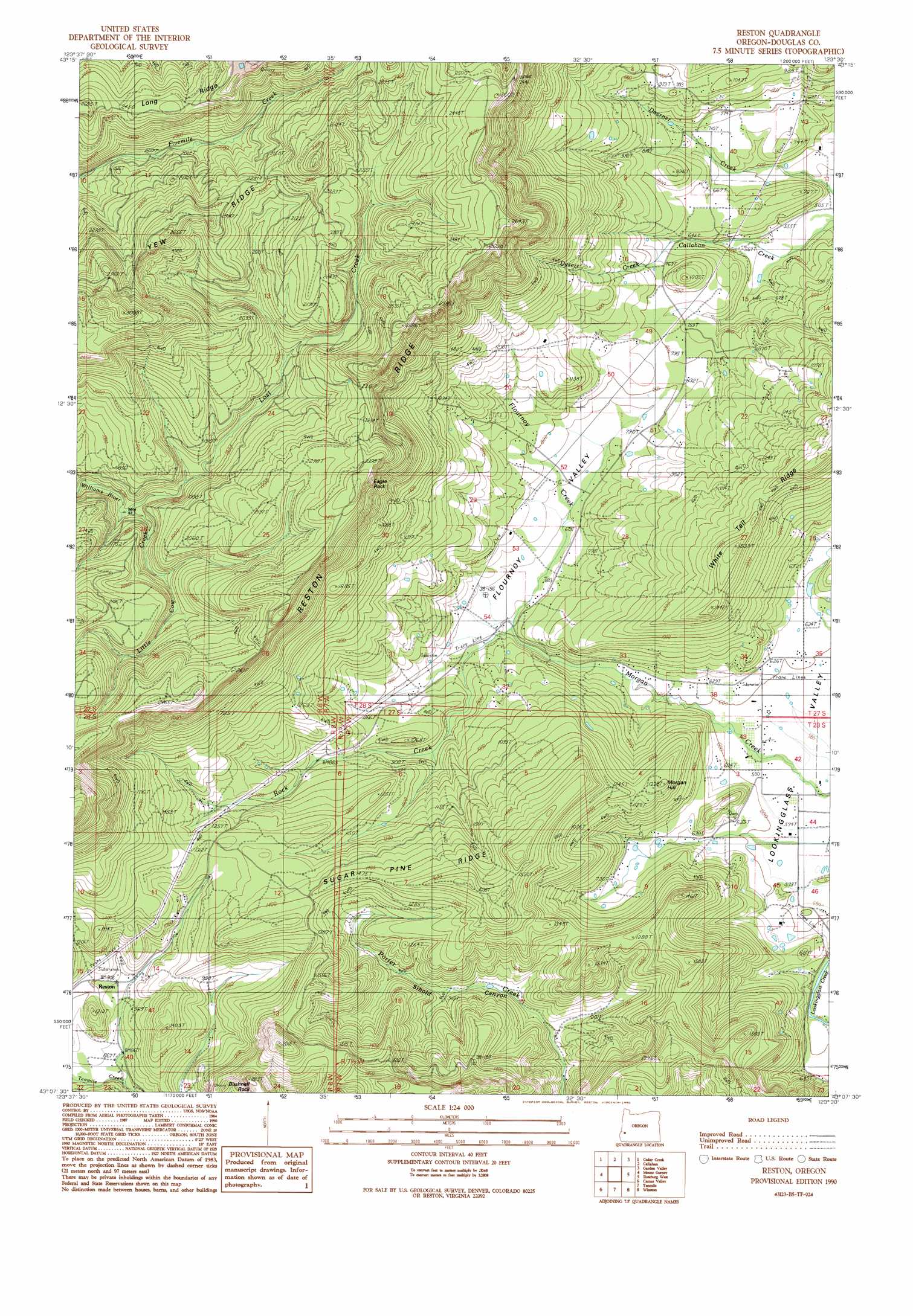
Reston Topo Map Oregon
To zoom in, hover over the map of Reston
USGS Topo Quad 43123b5 - 1:24,000 scale
| Topo Map Name: | Reston |
| USGS Topo Quad ID: | 43123b5 |
| Print Size: | ca. 21 1/4" wide x 27" high |
| Southeast Coordinates: | 43.125° N latitude / 123.5° W longitude |
| Map Center Coordinates: | 43.1875° N latitude / 123.5625° W longitude |
| U.S. State: | OR |
| Filename: | o43123b5.jpg |
| Download Map JPG Image: | Reston topo map 1:24,000 scale |
| Map Type: | Topographic |
| Topo Series: | 7.5´ |
| Map Scale: | 1:24,000 |
| Source of Map Images: | United States Geological Survey (USGS) |
| Alternate Map Versions: |
Reston OR 1990, updated 1990 Download PDF Buy paper map Reston OR 2011 Download PDF Buy paper map Reston OR 2014 Download PDF Buy paper map |
1:24,000 Topo Quads surrounding Reston
Ivers Peak |
Kelly Butte |
Tyee |
Tyee Mountain |
Sutherlin |
Tioga |
Cedar Creek |
Callahan |
Garden Valley |
Winchester |
Sitkum |
Mount Gurney |
Reston |
Roseburg West |
Roseburg East |
Kenyon Mountain |
Camas Valley |
Tenmile |
Winston |
Myrtle Creek |
Bone Mountain |
Chipmunk Ridge |
Live Oak Mountain |
Nickel Mountain |
Canyonville |
> Back to 43123a1 at 1:100,000 scale
> Back to 43122a1 at 1:250,000 scale
> Back to U.S. Topo Maps home
Reston topo map: Gazetteer
Reston: Basins
Flournoy Valley elevation 201m 659′Reston: Pillars
Bushnell Rock elevation 459m 1505′Reston: Populated Places
Reston elevation 268m 879′Reston: Post Offices
Reston Post Office (historical) elevation 268m 879′Reston: Reservoirs
Doerner Creek Reservoir elevation 224m 734′Smith Reservoir elevation 237m 777′
Wylie Reservoir elevation 204m 669′
Reston: Ridges
Long Ridge elevation 749m 2457′Reston Ridge elevation 686m 2250′
Sugar Pine Ridge elevation 444m 1456′
White Tail Ridge elevation 423m 1387′
Reston: Streams
Dysert Creek elevation 207m 679′East Fork Byron Creek elevation 267m 875′
Flournoy Creek elevation 195m 639′
Little Cow Creek elevation 489m 1604′
Lost Creek elevation 489m 1604′
Rock Creek elevation 195m 639′
Reston: Summits
Eagle Rock elevation 749m 2457′Morgan Hill elevation 368m 1207′
Reston digital topo map on disk
Buy this Reston topo map showing relief, roads, GPS coordinates and other geographical features, as a high-resolution digital map file on DVD: