Sitkum Topo Map Oregon
To zoom in, hover over the map of Sitkum
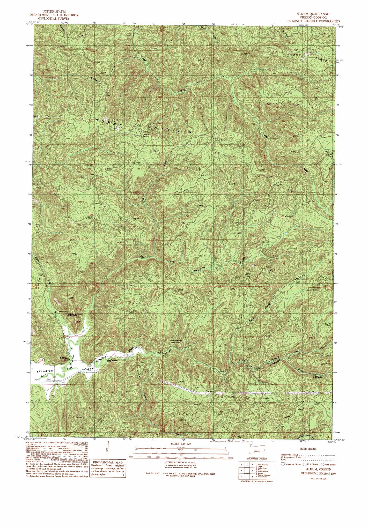
USGS Topo Quad 43123b7 - 1:24,000 scale
| Topo Map Name: | Sitkum |
| USGS Topo Quad ID: | 43123b7 |
| Print Size: | ca. 21 1/4" wide x 27" high |
| Southeast Coordinates: | 43.125° N latitude / 123.75° W longitude |
| Map Center Coordinates: | 43.1875° N latitude / 123.8125° W longitude |
| U.S. State: | OR |
| Filename: | o43123b7.jpg |
| Download Map JPG Image: | Sitkum topo map 1:24,000 scale |
| Map Type: | Topographic |
| Topo Series: | 7.5´ |
| Map Scale: | 1:24,000 |
| Source of Map Images: | United States Geological Survey (USGS) |
| Alternate Map Versions: |
Sitkum OR 1990, updated 1990 Download PDF Buy paper map Sitkum OR 2011 Download PDF Buy paper map Sitkum OR 2014 Download PDF Buy paper map |
1:24,000 Topo Quads surrounding Sitkum
Allegany |
Golden Falls |
Ivers Peak |
Kelly Butte |
Tyee |
Daniels Creek |
Coos Mountain |
Tioga |
Cedar Creek |
Callahan |
Mckinley |
Dora |
Sitkum |
Mount Gurney |
Reston |
Bridge |
Remote |
Kenyon Mountain |
Camas Valley |
Tenmile |
Powers |
Rasler Creek |
Bone Mountain |
Chipmunk Ridge |
Live Oak Mountain |
> Back to 43123a1 at 1:100,000 scale
> Back to 43122a1 at 1:250,000 scale
> Back to U.S. Topo Maps home
Sitkum topo map: Gazetteer
Sitkum: Parks
Burnt Mountain Recreation Site elevation 701m 2299′Judge Hamilton County Park elevation 260m 853′
Maria C Jackson State Park elevation 189m 620′
Sitkum: Populated Places
Sitkum elevation 216m 708′Sitkum: Post Offices
Sitkum Post Office (historical) elevation 216m 708′Sitkum: Ridges
Burnt Ridge elevation 756m 2480′Sitkum: Streams
Brummit Creek elevation 176m 577′Camas Creek elevation 195m 639′
Canyon Creek elevation 178m 583′
Dead Horse Creek elevation 252m 826′
East Fork Brummit Creek elevation 183m 600′
Lost Creek elevation 330m 1082′
Middle Fork Brummit Creek elevation 321m 1053′
West Fork Brummit Creek elevation 183m 600′
Sitkum: Summits
Burnt Mountain elevation 683m 2240′Sitkum digital topo map on disk
Buy this Sitkum topo map showing relief, roads, GPS coordinates and other geographical features, as a high-resolution digital map file on DVD: