Oak Creek Valley Topo Map Oregon
To zoom in, hover over the map of Oak Creek Valley
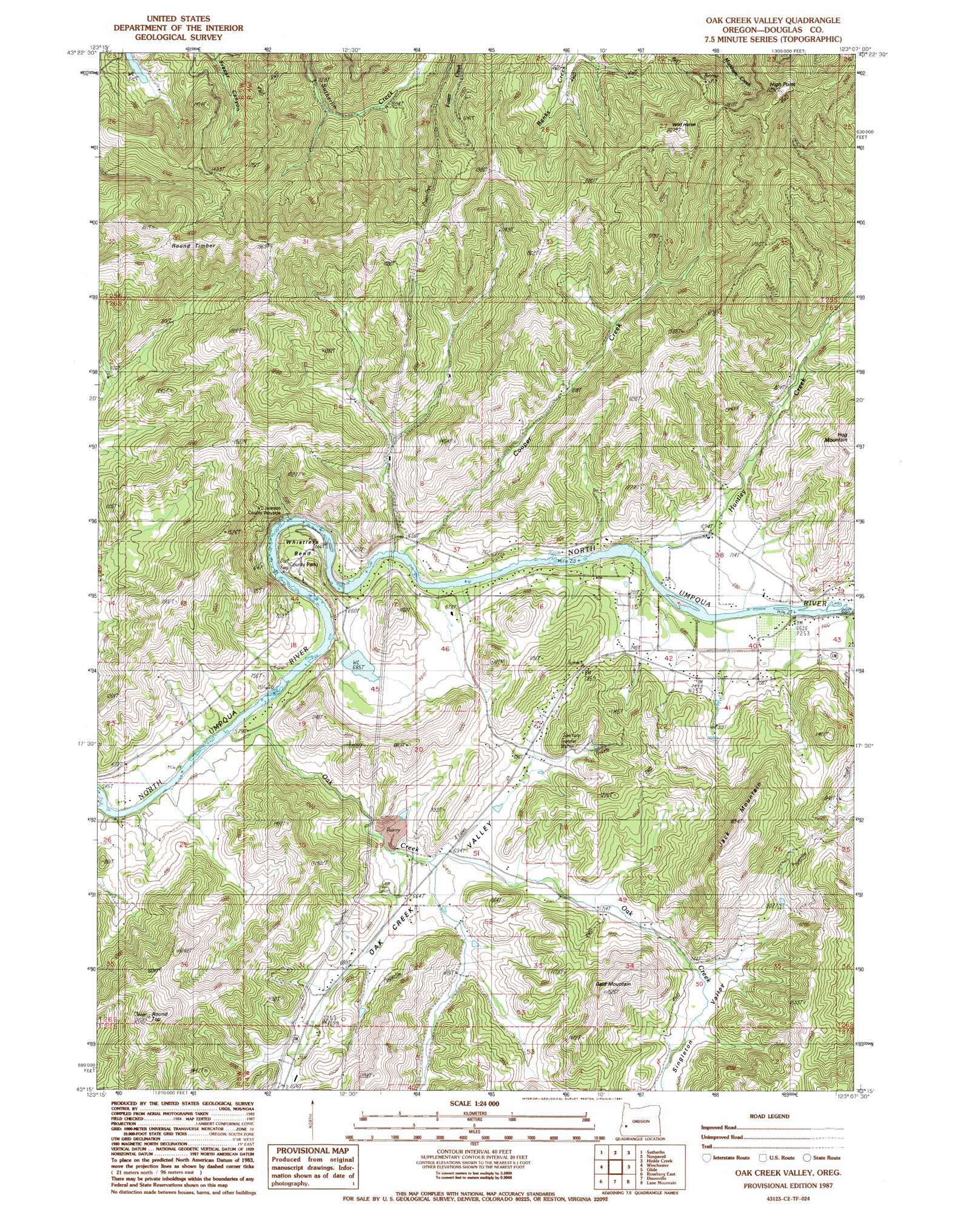
USGS Topo Quad 43123c2 - 1:24,000 scale
| Topo Map Name: | Oak Creek Valley |
| USGS Topo Quad ID: | 43123c2 |
| Print Size: | ca. 21 1/4" wide x 27" high |
| Southeast Coordinates: | 43.25° N latitude / 123.125° W longitude |
| Map Center Coordinates: | 43.3125° N latitude / 123.1875° W longitude |
| U.S. State: | OR |
| Filename: | o43123c2.jpg |
| Download Map JPG Image: | Oak Creek Valley topo map 1:24,000 scale |
| Map Type: | Topographic |
| Topo Series: | 7.5´ |
| Map Scale: | 1:24,000 |
| Source of Map Images: | United States Geological Survey (USGS) |
| Alternate Map Versions: |
Oak Creek Valley OR 1987, updated 1987 Download PDF Buy paper map Oak Creek Valley OR 2011 Download PDF Buy paper map Oak Creek Valley OR 2014 Download PDF Buy paper map |
1:24,000 Topo Quads surrounding Oak Creek Valley
Yellow Butte |
Yoncalla |
Scotts Valley |
Harness Mountain |
Burnt Mountain |
Tyee Mountain |
Sutherlin |
Nonpareil |
Hinkle Creek |
Harrington Creek |
Garden Valley |
Winchester |
Oak Creek Valley |
Glide |
Old Fairview |
Roseburg West |
Roseburg East |
Dixonville |
Lane Mountain |
Red Butte |
Winston |
Myrtle Creek |
Dodson Butte |
White Rock |
Deadman Mountain |
> Back to 43123a1 at 1:100,000 scale
> Back to 43122a1 at 1:250,000 scale
> Back to U.S. Topo Maps home
Oak Creek Valley topo map: Gazetteer
Oak Creek Valley: Bends
Whistlers Bend elevation 181m 593′Oak Creek Valley: Dams
Whistlers Bend Dam elevation 210m 688′Oak Creek Valley: Parks
V T Jackson County Wayside elevation 204m 669′Whistler Bend County Park elevation 185m 606′
Oak Creek Valley: Populated Places
Oak Creek (historical) elevation 215m 705′Oak Creek Valley: Post Offices
Mount Scott Post Office (historical) elevation 228m 748′Oak Creek Post Office (historical) elevation 215m 705′
Robinson Post Office (historical) elevation 258m 846′
Oak Creek Valley: Reservoirs
Whistlers Bend Reservoir elevation 210m 688′Oak Creek Valley: Streams
Bull Creek elevation 175m 574′Cooper Creek elevation 186m 610′
Fordice Creek elevation 207m 679′
Huntley Creek elevation 196m 643′
Jackson Creek elevation 196m 643′
Oak Creek elevation 171m 561′
Oak Creek Valley: Summits
Bald Mountain elevation 456m 1496′High Point elevation 478m 1568′
Jack Mountain elevation 563m 1847′
Round Timber elevation 560m 1837′
Round Top elevation 613m 2011′
Wild Horse elevation 610m 2001′
Oak Creek Valley: Valleys
Oak Creek Valley elevation 225m 738′Singleton Valley elevation 226m 741′
Oak Creek Valley digital topo map on disk
Buy this Oak Creek Valley topo map showing relief, roads, GPS coordinates and other geographical features, as a high-resolution digital map file on DVD: