Callahan Topo Map Oregon
To zoom in, hover over the map of Callahan
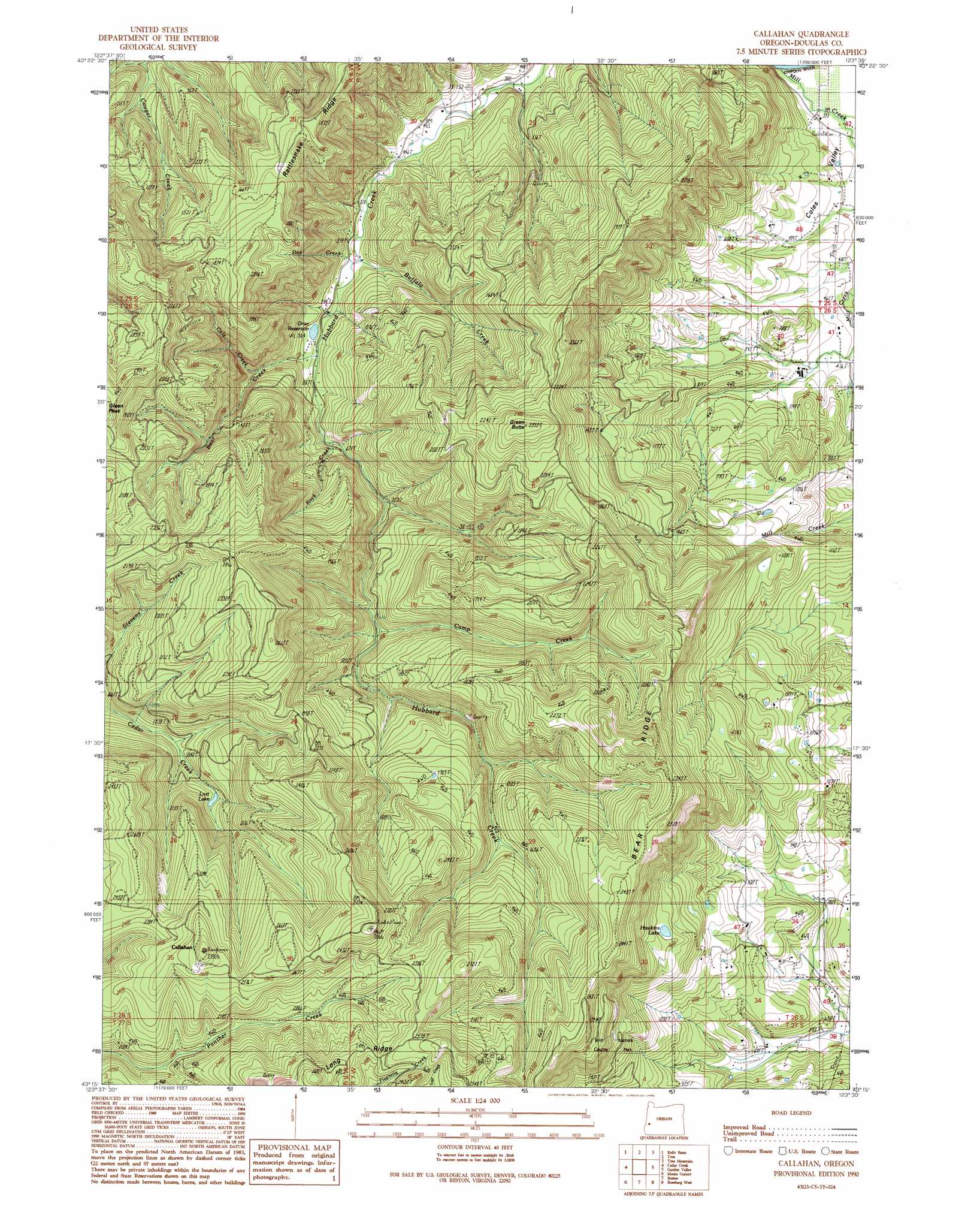
USGS Topo Quad 43123c5 - 1:24,000 scale
| Topo Map Name: | Callahan |
| USGS Topo Quad ID: | 43123c5 |
| Print Size: | ca. 21 1/4" wide x 27" high |
| Southeast Coordinates: | 43.25° N latitude / 123.5° W longitude |
| Map Center Coordinates: | 43.3125° N latitude / 123.5625° W longitude |
| U.S. State: | OR |
| Filename: | o43123c5.jpg |
| Download Map JPG Image: | Callahan topo map 1:24,000 scale |
| Map Type: | Topographic |
| Topo Series: | 7.5´ |
| Map Scale: | 1:24,000 |
| Source of Map Images: | United States Geological Survey (USGS) |
| Alternate Map Versions: |
Callahan OR 1990, updated 1990 Download PDF Buy paper map Callahan OR 2011 Download PDF Buy paper map Callahan OR 2014 Download PDF Buy paper map |
1:24,000 Topo Quads surrounding Callahan
Loon Lake |
Old Blue |
Kellogg |
Yellow Butte |
Yoncalla |
Ivers Peak |
Kelly Butte |
Tyee |
Tyee Mountain |
Sutherlin |
Tioga |
Cedar Creek |
Callahan |
Garden Valley |
Winchester |
Sitkum |
Mount Gurney |
Reston |
Roseburg West |
Roseburg East |
Kenyon Mountain |
Camas Valley |
Tenmile |
Winston |
Myrtle Creek |
> Back to 43123a1 at 1:100,000 scale
> Back to 43122a1 at 1:250,000 scale
> Back to U.S. Topo Maps home
Callahan topo map: Gazetteer
Callahan: Lakes
Hawkins Lake elevation 479m 1571′Lost Lake elevation 469m 1538′
Callahan: Parks
Britt Park elevation 530m 1738′Callahan: Populated Places
Callahan elevation 849m 2785′Coles Valley elevation 108m 354′
Callahan: Post Offices
Coles Valley Post Office (historical) elevation 108m 354′Callahan: Rapids
Churchill Rapids elevation 93m 305′Callahan: Reservoirs
Grier Reservoir elevation 180m 590′Callahan: Ridges
Bear Ridge elevation 749m 2457′Callahan: Streams
Bear Creek elevation 182m 597′Buffalo Creek elevation 150m 492′
Camp Creek elevation 302m 990′
Cole Creek elevation 235m 770′
Day Creek elevation 532m 1745′
Mill Creek elevation 160m 524′
Mill Creek elevation 108m 354′
Rock Creek elevation 198m 649′
Willow Creek elevation 280m 918′
Callahan: Summits
Green Butte elevation 772m 2532′Callahan: Valleys
Coles Valley elevation 98m 321′Callahan digital topo map on disk
Buy this Callahan topo map showing relief, roads, GPS coordinates and other geographical features, as a high-resolution digital map file on DVD: