Ivers Peak Topo Map Oregon
To zoom in, hover over the map of Ivers Peak
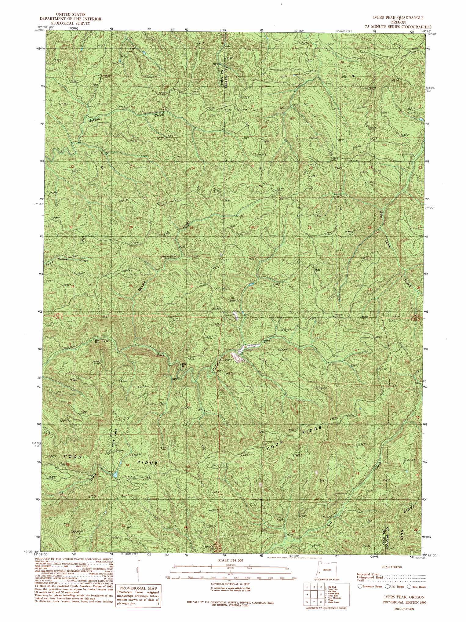
USGS Topo Quad 43123d7 - 1:24,000 scale
| Topo Map Name: | Ivers Peak |
| USGS Topo Quad ID: | 43123d7 |
| Print Size: | ca. 21 1/4" wide x 27" high |
| Southeast Coordinates: | 43.375° N latitude / 123.75° W longitude |
| Map Center Coordinates: | 43.4375° N latitude / 123.8125° W longitude |
| U.S. State: | OR |
| Filename: | o43123d7.jpg |
| Download Map JPG Image: | Ivers Peak topo map 1:24,000 scale |
| Map Type: | Topographic |
| Topo Series: | 7.5´ |
| Map Scale: | 1:24,000 |
| Source of Map Images: | United States Geological Survey (USGS) |
| Alternate Map Versions: |
Ivers Peak OR 1990, updated 1990 Download PDF Buy paper map Ivers Peak OR 2011 Download PDF Buy paper map Ivers Peak OR 2014 Download PDF Buy paper map |
1:24,000 Topo Quads surrounding Ivers Peak
Reedsport |
Deer Head Point |
Scottsburg |
Devils Graveyard |
Elkton |
Trail Butte |
Eck Peak |
Loon Lake |
Old Blue |
Kellogg |
Allegany |
Golden Falls |
Ivers Peak |
Kelly Butte |
Tyee |
Daniels Creek |
Coos Mountain |
Tioga |
Cedar Creek |
Callahan |
Mckinley |
Dora |
Sitkum |
Mount Gurney |
Reston |
> Back to 43123a1 at 1:100,000 scale
> Back to 43122a1 at 1:250,000 scale
> Back to U.S. Topo Maps home
Ivers Peak topo map: Gazetteer
Ivers Peak: Ridges
Coos Ridge elevation 647m 2122′High Ridge elevation 574m 1883′
Ivers Peak: Streams
Bear Camp Creek elevation 207m 679′Beulah Creek elevation 212m 695′
Ivers Peak: Summits
Ivers Peak elevation 724m 2375′Ivers Peak digital topo map on disk
Buy this Ivers Peak topo map showing relief, roads, GPS coordinates and other geographical features, as a high-resolution digital map file on DVD: