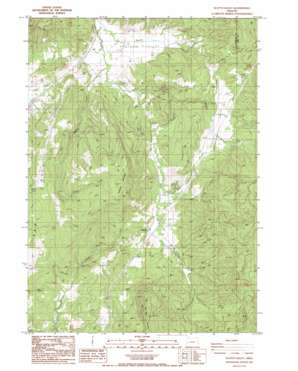
Scotts Valley Topo Map Oregon
To zoom in, hover over the map of Scotts Valley
USGS Topo Quad 43123e2 - 1:24,000 scale
| Topo Map Name: | Scotts Valley |
| USGS Topo Quad ID: | 43123e2 |
| Print Size: | ca. 21 1/4" wide x 27" high |
| Southeast Coordinates: | 43.5° N latitude / 123.125° W longitude |
| Map Center Coordinates: | 43.5625° N latitude / 123.1875° W longitude |
| U.S. State: | OR |
| Filename: | o43123e2.jpg |
| Download Map JPG Image: | Scotts Valley topo map 1:24,000 scale |
| Map Type: | Topographic |
| Topo Series: | 7.5´ |
| Map Scale: | 1:24,000 |
| Source of Map Images: | United States Geological Survey (USGS) |
| Alternate Map Versions: |
Scotts Valley OR 1987, updated 1987 Download PDF Buy paper map Scotts Valley OR 2011 Download PDF Buy paper map Scotts Valley OR 2014 Download PDF Buy paper map |
1:24,000 Topo Quads surrounding Scotts Valley
> Back to 43123e1 at 1:100,000 scale
> Back to 43122a1 at 1:250,000 scale
> Back to U.S. Topo Maps home
Scotts Valley topo map: Gazetteer
Scotts Valley: Basins
Shoestring Valley elevation 272m 892′Scotts Valley: Bridges
Grant Applegate Bridge elevation 136m 446′Milltown Hill Bridge elevation 152m 498′
Scotts Valley: Mines
Elkhead Mines elevation 262m 859′Scotts Valley: Populated Places
Calvert (historical) elevation 151m 495′Elkhead elevation 245m 803′
Scotts Valley: Post Offices
Calvert Post Office (historical) elevation 151m 495′Elkhead Post Office (historical) elevation 245m 803′
Ila Post Office (historical) elevation 352m 1154′
Stacey Post Office (historical) elevation 123m 403′
Scotts Valley: Streams
Adams Creek elevation 134m 439′Bennet Creek elevation 118m 387′
Buck Creek elevation 252m 826′
Lane Creek elevation 230m 754′
North Fork Walker Creek elevation 246m 807′
Schoolhouse Creek elevation 131m 429′
Shingle Mill Creek elevation 253m 830′
Titus Creek elevation 153m 501′
Walker Creek elevation 197m 646′
Scotts Valley: Summits
Ben More Mountain elevation 766m 2513′Dickinson Mountain elevation 662m 2171′
Milltown Hill elevation 358m 1174′
Red Hill elevation 460m 1509′
Scotts Valley: Valleys
Pleasant Valley elevation 169m 554′Scotts Valley elevation 120m 393′
Scotts Valley digital topo map on disk
Buy this Scotts Valley topo map showing relief, roads, GPS coordinates and other geographical features, as a high-resolution digital map file on DVD:


