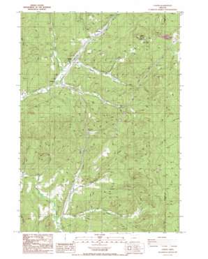
Curtin Topo Map Oregon
To zoom in, hover over the map of Curtin
USGS Topo Quad 43123f2 - 1:24,000 scale
| Topo Map Name: | Curtin |
| USGS Topo Quad ID: | 43123f2 |
| Print Size: | ca. 21 1/4" wide x 27" high |
| Southeast Coordinates: | 43.625° N latitude / 123.125° W longitude |
| Map Center Coordinates: | 43.6875° N latitude / 123.1875° W longitude |
| U.S. State: | OR |
| Filename: | o43123f2.jpg |
| Download Map JPG Image: | Curtin topo map 1:24,000 scale |
| Map Type: | Topographic |
| Topo Series: | 7.5´ |
| Map Scale: | 1:24,000 |
| Source of Map Images: | United States Geological Survey (USGS) |
| Alternate Map Versions: |
Curtin OR 1987, updated 1987 Download PDF Buy paper map Curtin OR 2011 Download PDF Buy paper map Curtin OR 2014 Download PDF Buy paper map |
1:24,000 Topo Quads surrounding Curtin
> Back to 43123e1 at 1:100,000 scale
> Back to 43122a1 at 1:250,000 scale
> Back to U.S. Topo Maps home
Curtin topo map: Gazetteer
Curtin: Parks
Pass Creek County Park elevation 134m 439′Curtin: Populated Places
Anlauf elevation 119m 390′Comstock elevation 140m 459′
Curtin elevation 123m 403′
Curtin: Post Offices
Anlauf Post Office (historical) elevation 119m 390′Comstock Post Office (historical) elevation 140m 459′
Curtin Post Office elevation 123m 403′
Curtin: Reservoirs
Lake Diane elevation 126m 413′Lawrence Reservoir elevation 284m 931′
Curtin: Streams
Anlauf Creek elevation 167m 547′Bear Creek elevation 124m 406′
Buck Creek elevation 117m 383′
Cox Creek elevation 117m 383′
Curtis Creek elevation 137m 449′
Lees Creek elevation 148m 485′
Pheasant Creek elevation 120m 393′
Salt Creek elevation 113m 370′
Schafer Creek elevation 164m 538′
Seeley Creek elevation 129m 423′
Simpson Creek elevation 118m 387′
Ward Creek elevation 135m 442′
Wehmeyer Creek elevation 106m 347′
Curtin: Summits
Cuttock Butte elevation 697m 2286′Doolittle Butte elevation 644m 2112′
Redford Butte elevation 471m 1545′
Sliter Butte elevation 652m 2139′
Spike Buck Butte elevation 629m 2063′
Wards Butte elevation 624m 2047′
Curtin digital topo map on disk
Buy this Curtin topo map showing relief, roads, GPS coordinates and other geographical features, as a high-resolution digital map file on DVD:


