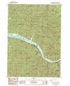
Deer Head Point Topo Map Oregon
To zoom in, hover over the map of Deer Head Point
USGS Topo Quad 43123f8 - 1:24,000 scale
| Topo Map Name: | Deer Head Point |
| USGS Topo Quad ID: | 43123f8 |
| Print Size: | ca. 21 1/4" wide x 27" high |
| Southeast Coordinates: | 43.625° N latitude / 123.875° W longitude |
| Map Center Coordinates: | 43.6875° N latitude / 123.9375° W longitude |
| U.S. State: | OR |
| Filename: | o43123f8.jpg |
| Download Map JPG Image: | Deer Head Point topo map 1:24,000 scale |
| Map Type: | Topographic |
| Topo Series: | 7.5´ |
| Map Scale: | 1:24,000 |
| Source of Map Images: | United States Geological Survey (USGS) |
| Alternate Map Versions: |
Deer Head Point OR 1985, updated 1985 Download PDF Buy paper map Deer Head Point OR 2011 Download PDF Buy paper map Deer Head Point OR 2014 Download PDF Buy paper map |
| FStopo: | US Forest Service topo Deer Head Point is available: Download FStopo PDF Download FStopo TIF |
1:24,000 Topo Quads surrounding Deer Head Point
> Back to 43123e1 at 1:100,000 scale
> Back to 43122a1 at 1:250,000 scale
> Back to U.S. Topo Maps home
Deer Head Point topo map: Gazetteer
Deer Head Point: Bars
Brandy Bar elevation 2m 6′Deer Head Point: Capes
Deer Head Point elevation 419m 1374′Deer Head Point: Islands
Echo Island elevation 0m 0′Deer Head Point: Parks
Umpqua State Scenic Corridor elevation 80m 262′Deer Head Point: Ridges
Lunch Ridge elevation 267m 875′Skagit Ridge elevation 322m 1056′
Deer Head Point: Streams
Bear Creek elevation 12m 39′Cedar Creek elevation 13m 42′
Charlotte Creek elevation 3m 9′
Fischer Creek elevation 12m 39′
Franklin Creek elevation 10m 32′
Harvey Creek elevation 16m 52′
Indian Charlie Creek elevation 3m 9′
Johnson Creek elevation 9m 29′
Little Franklin Creek elevation 110m 360′
Luder Creek elevation 3m 9′
Deer Head Point: Valleys
Devils Club Canyon elevation 142m 465′Deer Head Point digital topo map on disk
Buy this Deer Head Point topo map showing relief, roads, GPS coordinates and other geographical features, as a high-resolution digital map file on DVD:


