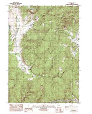
Lorane Topo Map Oregon
To zoom in, hover over the map of Lorane
USGS Topo Quad 43123g2 - 1:24,000 scale
| Topo Map Name: | Lorane |
| USGS Topo Quad ID: | 43123g2 |
| Print Size: | ca. 21 1/4" wide x 27" high |
| Southeast Coordinates: | 43.75° N latitude / 123.125° W longitude |
| Map Center Coordinates: | 43.8125° N latitude / 123.1875° W longitude |
| U.S. State: | OR |
| Filename: | o43123g2.jpg |
| Download Map JPG Image: | Lorane topo map 1:24,000 scale |
| Map Type: | Topographic |
| Topo Series: | 7.5´ |
| Map Scale: | 1:24,000 |
| Source of Map Images: | United States Geological Survey (USGS) |
| Alternate Map Versions: |
Lorane OR 1984, updated 1984 Download PDF Buy paper map Lorane OR 2011 Download PDF Buy paper map Lorane OR 2014 Download PDF Buy paper map |
1:24,000 Topo Quads surrounding Lorane
> Back to 43123e1 at 1:100,000 scale
> Back to 43122a1 at 1:250,000 scale
> Back to U.S. Topo Maps home
Lorane topo map: Gazetteer
Lorane: Parks
Pass Creek State Wayside (historical) elevation 157m 515′Lorane: Populated Places
Lorane elevation 208m 682′Mill Camp elevation 208m 682′
Royal elevation 248m 813′
Lorane: Post Offices
Cartwrights Post Office (historical) elevation 307m 1007′Lorane Post Office elevation 208m 682′
Royal Post Office (historical) elevation 248m 813′
Lorane: Reservoirs
Marsh Creek Pond elevation 376m 1233′Nossaman Reservoir elevation 255m 836′
Lorane: Ridges
Green Ridge elevation 379m 1243′Hawley Ridge elevation 400m 1312′
Long Ridge elevation 376m 1233′
Lorane: Streams
Barlow Creek elevation 237m 777′Crow Creek elevation 206m 675′
Farman Creek elevation 198m 649′
Hawley Creek elevation 201m 659′
Kelly Creek elevation 209m 685′
Lucas Creek elevation 198m 649′
Maxwell Creek elevation 254m 833′
Muslin Creek elevation 230m 754′
Norris Creek elevation 202m 662′
Sandy Creek elevation 254m 833′
Tucker Creek elevation 226m 741′
Lorane: Summits
Bald Butte elevation 499m 1637′Lorane Mountain elevation 445m 1459′
Round Mountain elevation 515m 1689′
Lorane digital topo map on disk
Buy this Lorane topo map showing relief, roads, GPS coordinates and other geographical features, as a high-resolution digital map file on DVD:


