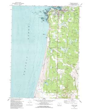
Bandon Topo Map Oregon
To zoom in, hover over the map of Bandon
USGS Topo Quad 43124a4 - 1:24,000 scale
| Topo Map Name: | Bandon |
| USGS Topo Quad ID: | 43124a4 |
| Print Size: | ca. 21 1/4" wide x 27" high |
| Southeast Coordinates: | 43° N latitude / 124.375° W longitude |
| Map Center Coordinates: | 43.0625° N latitude / 124.4375° W longitude |
| U.S. State: | OR |
| Filename: | o43124a4.jpg |
| Download Map JPG Image: | Bandon topo map 1:24,000 scale |
| Map Type: | Topographic |
| Topo Series: | 7.5´ |
| Map Scale: | 1:24,000 |
| Source of Map Images: | United States Geological Survey (USGS) |
| Alternate Map Versions: |
Bandon OR 1970, updated 1973 Download PDF Buy paper map Bandon OR 1970, updated 1993 Download PDF Buy paper map Bandon OR 2011 Download PDF Buy paper map Bandon OR 2014 Download PDF Buy paper map |
1:24,000 Topo Quads surrounding Bandon
Cape Arago |
Charleston |
Coos Bay |
||
Bullards |
Riverton |
Coquille |
||
Bandon |
Bill Peak |
Myrtle Point |
||
Floras Lake |
Langlois |
Calf Ranch Mountain |
Dement Creek |
|
Cape Blanco |
Sixes |
Mount Butler |
Barklow Mountain |
> Back to 43124a1 at 1:100,000 scale
> Back to 43124a1 at 1:250,000 scale
> Back to U.S. Topo Maps home
Bandon topo map: Gazetteer
Bandon: Airports
Bandon State Airport elevation 33m 108′Bandon: Beaches
Bandon Beach elevation 0m 0′Bandon: Capes
Coquille Point elevation 0m 0′Gravel Point elevation 0m 0′
Bandon: Islands
Black Rock elevation 0m 0′Cat and Kittens Rock elevation 0m 0′
Face Rock elevation -1m -4′
Five Foot Rock elevation 0m 0′
Haystack Rock elevation 28m 91′
Sisters elevation 0m 0′
Table Rock elevation 8m 26′
Wash Rock elevation 0m 0′
Bandon: Lakes
Bradley Lake elevation 7m 22′Laurel Lake elevation 5m 16′
Lost Lake elevation 8m 26′
Bandon: Parks
Bandon State Park elevation 8m 26′Bradley Lake Boat Ramp elevation 8m 26′
Brandon South Jetty County Park elevation 1m 3′
City Park elevation 25m 82′
Face Rock State Park elevation 10m 32′
Kronenberg County Park elevation 24m 78′
New River County Park elevation 28m 91′
Bandon: Pillars
Tupper Rock (historical) elevation 8m 26′Bandon: Populated Places
Bandon elevation 3m 9′Dew Valley elevation 31m 101′
Fourmile elevation 26m 85′
Laurel Grove elevation 36m 118′
Bandon: Post Offices
Bandon Post Office elevation 3m 9′Fourmile Post Office (historical) elevation 26m 85′
Bandon: Reservoirs
Bandon Reservoir elevation 42m 137′Dahl Log Pond elevation 19m 62′
Ferry Creek Reservoir elevation 23m 75′
Geiger Creek Reservoir elevation 22m 72′
Hawley Reservoir elevation 45m 147′
Bandon: Streams
Baker Creek elevation 80m 262′China Creek elevation 3m 9′
Coquille River elevation 0m 0′
Crooked Creek elevation 5m 16′
Dufort Creek elevation 31m 101′
Ferry Creek elevation 3m 9′
Fourmile Creek elevation 0m 0′
Geiger Creek elevation 19m 62′
Gross Creek elevation 13m 42′
Johnson Creek elevation 2m 6′
Lower Twomile Creek elevation 8m 26′
New River elevation 1m 3′
Redibaugh Creek elevation 19m 62′
Rosa Creek elevation 16m 52′
South Twomile Creek elevation 7m 22′
Spring Creek elevation 5m 16′
Tupper Creek elevation 27m 88′
Twomile Creek elevation 2m 6′
Bandon: Valleys
Dew Valley elevation 7m 22′Bandon digital topo map on disk
Buy this Bandon topo map showing relief, roads, GPS coordinates and other geographical features, as a high-resolution digital map file on DVD:


