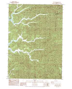
Trail Butte Topo Map Oregon
To zoom in, hover over the map of Trail Butte
USGS Topo Quad 43124e1 - 1:24,000 scale
| Topo Map Name: | Trail Butte |
| USGS Topo Quad ID: | 43124e1 |
| Print Size: | ca. 21 1/4" wide x 27" high |
| Southeast Coordinates: | 43.5° N latitude / 124° W longitude |
| Map Center Coordinates: | 43.5625° N latitude / 124.0625° W longitude |
| U.S. State: | OR |
| Filename: | o43124e1.jpg |
| Download Map JPG Image: | Trail Butte topo map 1:24,000 scale |
| Map Type: | Topographic |
| Topo Series: | 7.5´ |
| Map Scale: | 1:24,000 |
| Source of Map Images: | United States Geological Survey (USGS) |
| Alternate Map Versions: |
Trail Butte OR 1985, updated 1985 Download PDF Buy paper map Trail Butte OR 2011 Download PDF Buy paper map Trail Butte OR 2014 Download PDF Buy paper map |
1:24,000 Topo Quads surrounding Trail Butte
> Back to 43124e1 at 1:100,000 scale
> Back to 43124a1 at 1:250,000 scale
> Back to U.S. Topo Maps home
Trail Butte topo map: Gazetteer
Trail Butte: Bays
Big Creek Arm elevation 4m 13′Carlson Arm elevation 4m 13′
Coleman Arm elevation 4m 13′
Templeton Arm elevation 4m 13′
Trail Butte: Populated Places
Templeton elevation 19m 62′Trail Butte: Post Offices
Templeton Post Office (historical) elevation 19m 62′Trail Butte: Streams
Benson Creek elevation 4m 13′Big Creek elevation 6m 19′
Copple Creek elevation 5m 16′
Hatchery Creek elevation 22m 72′
Johnson Creek elevation 4m 13′
Murphy Creek elevation 7m 22′
Noble Creek elevation 10m 32′
Roberts Creek elevation 13m 42′
Robertson Creek elevation 7m 22′
Wilkins Creek elevation 6m 19′
Trail Butte: Summits
Tenmile Butte elevation 347m 1138′Trail Butte elevation 493m 1617′
Twin Sisters elevation 362m 1187′
Trail Butte: Valleys
Alder Gulch elevation 21m 68′Trail Butte digital topo map on disk
Buy this Trail Butte topo map showing relief, roads, GPS coordinates and other geographical features, as a high-resolution digital map file on DVD:


