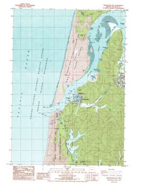
Winchester Bay Topo Map Oregon
To zoom in, hover over the map of Winchester Bay
USGS Topo Quad 43124f2 - 1:24,000 scale
| Topo Map Name: | Winchester Bay |
| USGS Topo Quad ID: | 43124f2 |
| Print Size: | ca. 21 1/4" wide x 27" high |
| Southeast Coordinates: | 43.625° N latitude / 124.125° W longitude |
| Map Center Coordinates: | 43.6875° N latitude / 124.1875° W longitude |
| U.S. State: | OR |
| Filename: | o43124f2.jpg |
| Download Map JPG Image: | Winchester Bay topo map 1:24,000 scale |
| Map Type: | Topographic |
| Topo Series: | 7.5´ |
| Map Scale: | 1:24,000 |
| Source of Map Images: | United States Geological Survey (USGS) |
| Alternate Map Versions: |
Winchester Bay OR 1985, updated 1985 Download PDF Buy paper map Winchester Bay OR 2011 Download PDF Buy paper map Winchester Bay OR 2014 Download PDF Buy paper map |
| FStopo: | US Forest Service topo Winchester Bay is available: Download FStopo PDF Download FStopo TIF |
1:24,000 Topo Quads surrounding Winchester Bay
Goose Pasture |
Florence |
Goodwin Peak |
||
Tahkenitch Creek |
Fivemile Creek |
North Fork |
||
Winchester Bay |
Reedsport |
Deer Head Point |
||
Lakeside |
Trail Butte |
Eck Peak |
||
Empire |
North Bend |
Allegany |
Golden Falls |
> Back to 43124e1 at 1:100,000 scale
> Back to 43124a1 at 1:250,000 scale
> Back to U.S. Topo Maps home
Winchester Bay topo map: Gazetteer
Winchester Bay: Bars
North Spit elevation 6m 19′Ork Reef elevation 2m 6′
Winchester Bay: Bays
Halfmoon Bay elevation 0m 0′Henderson Cove elevation 0m 0′
Hunt Cove elevation 0m 0′
Jerden Cove elevation 0m 0′
Macey Cove elevation 0m 0′
Winchester Bay elevation 2m 6′
Winchester Bay: Bends
The Cutoff elevation 0m 0′Winchester Bay: Capes
Cornwall Point elevation 39m 127′The Point elevation 2m 6′
Winchester Point elevation 2m 6′
Winchester Bay: Channels
Barretts Range Channel elevation 0m 0′Winchester Bay: Cliffs
Double Cove Point elevation 9m 29′Winchester Bay: Dams
Clear Lake Dam elevation 78m 255′Lake Edna Dam elevation 68m 223′
North Jetty elevation 0m 0′
South Jetty elevation 1m 3′
Winchester Bay: Harbors
East Basin elevation 0m 0′Salmon Harbor elevation 67m 219′
West Basin elevation 0m 0′
Winchester Bay: Lakes
Clear Lake elevation 71m 232′Lake Edna elevation 68m 223′
Lake Marie elevation 27m 88′
Teal Lake elevation 68m 223′
Winchester Bay: Parks
Bicentennial Park elevation 13m 42′Oak Rock County Park elevation 2m 6′
Oregon Dunes National Recreation Area elevation 0m 0′
Salmon Harbor County Park elevation 48m 157′
Umpqua Lighthouse State Park elevation 36m 118′
Windy Cove County Park elevation 21m 68′
Ziolkouski Beach Park elevation 5m 16′
Winchester Bay: Populated Places
Umpqua City (historical) elevation 1m 3′Willard (historical) elevation 56m 183′
Winchester Bay elevation 7m 22′
Winchester Bay: Post Offices
Umpqua City Post Office (historical) elevation 1m 3′Willard Post Office (historical) elevation 56m 183′
Winchester Bay Post Office elevation 7m 22′
Winchester Bay: Reservoirs
Clear Creek Reservoir elevation 78m 255′Winchester Bay: Streams
Marie Creek elevation 40m 131′Parker Creek elevation 13m 42′
Providence Creek elevation 0m 0′
Silver Creek elevation 7m 22′
Threemile Creek elevation 2m 6′
Umpqua River elevation 0m 0′
Winchester Creek elevation 5m 16′
Winchester Bay: Summits
Army Hill elevation 10m 32′Brushy Hill elevation 69m 226′
Drake Dune elevation 172m 564′
Winchester Bay digital topo map on disk
Buy this Winchester Bay topo map showing relief, roads, GPS coordinates and other geographical features, as a high-resolution digital map file on DVD:


