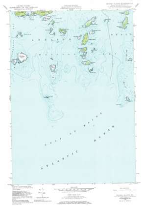
Drisko Island Topo Map Maine
To zoom in, hover over the map of Drisko Island
USGS Topo Quad 44067d6 - 1:24,000 scale
| Topo Map Name: | Drisko Island |
| USGS Topo Quad ID: | 44067d6 |
| Print Size: | ca. 21 1/4" wide x 27" high |
| Southeast Coordinates: | 44.375° N latitude / 67.625° W longitude |
| Map Center Coordinates: | 44.4375° N latitude / 67.6875° W longitude |
| U.S. State: | ME |
| Filename: | o44067d6.jpg |
| Download Map JPG Image: | Drisko Island topo map 1:24,000 scale |
| Map Type: | Topographic |
| Topo Series: | 7.5´ |
| Map Scale: | 1:24,000 |
| Source of Map Images: | United States Geological Survey (USGS) |
| Alternate Map Versions: |
Drisko Island ME 1948, updated 1969 Download PDF Buy paper map Drisko Island ME 1948, updated 1984 Download PDF Buy paper map Drisko Island ME 1950, updated 1950 Download PDF Buy paper map Drisko Island ME 2011 Download PDF Buy paper map Drisko Island ME 2014 Download PDF Buy paper map |
1:24,000 Topo Quads surrounding Drisko Island
Schoodic Lake |
Epping |
Columbia Falls |
Whitneyville |
Machias |
Cherryfield |
Harrington |
Addison |
Jonesport |
Roque Bluffs |
Petit Manan Point |
Bois Bubert |
Drisko Island |
Great Wass Island |
|
> Back to 44067a1 at 1:100,000 scale
> Back to 44066a1 at 1:250,000 scale
> Back to U.S. Topo Maps home
Drisko Island topo map: Gazetteer
Drisko Island: Bars
Browney Island Ledge elevation 0m 0′Diana Ledge elevation 0m 0′
Drawn Boys Ledges elevation 0m 0′
Drown Boys Ledges elevation 0m 0′
Eastern Ladle Ledge elevation 0m 0′
Flat Island Ledges elevation 0m 0′
Harbor Ledge elevation 0m 0′
Hay Ledge elevation 0m 0′
Plummer Ledge elevation 0m 0′
Ram Island Ledge elevation 0m 0′
The Sands elevation 0m 0′
Tibbett Ledge elevation 0m 0′
Western Ladle Ledge elevation 0m 0′
Drisko Island: Bays
Cape Split Harbor elevation 0m 0′Western Bay elevation 0m 0′
Drisko Island: Capes
Eastern Pitch elevation 0m 0′Drisko Island: Channels
Tibbett Narrows elevation 0m 0′Drisko Island: Islands
Batson Ledges elevation 0m 0′Big Nash Island elevation 4m 13′
Black Rock elevation 0m 0′
Drisko Island elevation 6m 19′
Egg Rock elevation 0m 0′
Flat Island elevation 3m 9′
Green Island elevation 0m 0′
Inner Sand Island elevation 12m 39′
Little Drisko Island elevation 0m 0′
Little Ram Island elevation 0m 0′
Marsh Island elevation 5m 16′
Nash Island elevation 6m 19′
Outer Ram Island elevation 7m 22′
Outer Sand Island elevation 7m 22′
Plummer Island elevation 11m 36′
Ram Island elevation 8m 26′
Ram Island elevation 0m 0′
Seaduck Rock elevation 0m 0′
Seahorse Rock elevation 0m 0′
Stanley Ledge elevation 0m 0′
Stevens Island elevation 5m 16′
The Ladle elevation 9m 29′
Tibbett Island elevation 4m 13′
Toms Island elevation 2m 6′
Drisko Island digital topo map on disk
Buy this Drisko Island topo map showing relief, roads, GPS coordinates and other geographical features, as a high-resolution digital map file on DVD:
Maine, New Hampshire, Rhode Island & Eastern Massachusetts
Buy digital topo maps: Maine, New Hampshire, Rhode Island & Eastern Massachusetts


