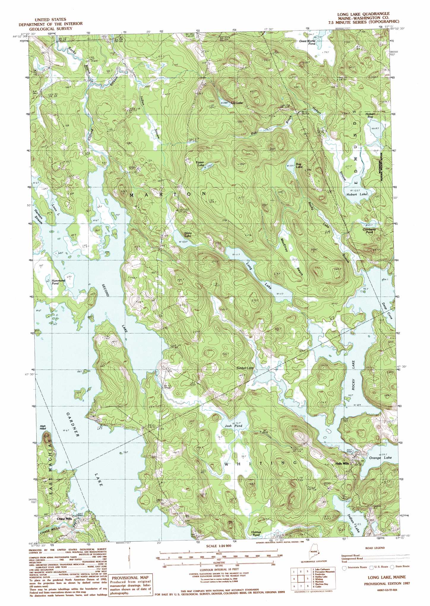
Long Lake Topo Map Maine
To zoom in, hover over the map of Long Lake
USGS Topo Quad 44067g3 - 1:24,000 scale
| Topo Map Name: | Long Lake |
| USGS Topo Quad ID: | 44067g3 |
| Print Size: | ca. 21 1/4" wide x 27" high |
| Southeast Coordinates: | 44.75° N latitude / 67.25° W longitude |
| Map Center Coordinates: | 44.8125° N latitude / 67.3125° W longitude |
| U.S. State: | ME |
| Filename: | o44067g3.jpg |
| Download Map JPG Image: | Long Lake topo map 1:24,000 scale |
| Map Type: | Topographic |
| Topo Series: | 7.5´ |
| Map Scale: | 1:24,000 |
| Source of Map Images: | United States Geological Survey (USGS) |
| Alternate Map Versions: |
Long Lake ME 1987, updated 1988 Download PDF Buy paper map Long Lake ME 2011 Download PDF Buy paper map Long Lake ME 2014 Download PDF Buy paper map |
1:24,000 Topo Quads surrounding Long Lake
Crawford Lake |
Meddybemp Lake West |
Meddybemp Lake East |
Red Beach |
Robbinston |
Round Lake |
Lake Cathance |
Porcupine Mountain |
Pembroke |
Eastport |
Bog Lake |
Hadley Lake |
Long Lake |
Whiting |
West Lubec |
Whitneyville |
Machias |
Machias Bay |
Cutler |
Moose River |
Jonesport |
Roque Bluffs |
Cross Island |
> Back to 44067e1 at 1:100,000 scale
> Back to 44066a1 at 1:250,000 scale
> Back to U.S. Topo Maps home
Long Lake topo map: Gazetteer
Long Lake: Dams
Chase Mill Dam elevation 20m 65′Hobart Bog Dam elevation 36m 118′
Long Lake: Lakes
Bog Lake elevation 49m 160′Cranberry Pond elevation 37m 121′
Foster Lake elevation 89m 291′
Gardner Lake elevation 20m 65′
Hammond Pond elevation 22m 72′
Hobart Lake elevation 38m 124′
Indian Lake elevation 37m 121′
Josh Pond elevation 22m 72′
Lily Lake elevation 88m 288′
Long Lake elevation 35m 114′
Loon Lake elevation 20m 65′
Second Lake elevation 20m 65′
Shiny Lake elevation 38m 124′
Sunken Lake elevation 27m 88′
Long Lake: Populated Places
Chase Mills elevation 20m 65′Halls Mills elevation 27m 88′
Long Lake: Reservoirs
Hobart Bog elevation 36m 118′Long Lake: Streams
Clifford Stream elevation 21m 68′Harmon Stream elevation 20m 65′
Indian Stream elevation 30m 98′
Pug Brook elevation 43m 141′
Rocky Brook elevation 29m 95′
Rocky Lake Stream elevation 27m 88′
Long Lake: Summits
High Head elevation 54m 177′Long Lake: Swamps
MacElroy Heath elevation 42m 137′Long Lake digital topo map on disk
Buy this Long Lake topo map showing relief, roads, GPS coordinates and other geographical features, as a high-resolution digital map file on DVD:
Maine, New Hampshire, Rhode Island & Eastern Massachusetts
Buy digital topo maps: Maine, New Hampshire, Rhode Island & Eastern Massachusetts