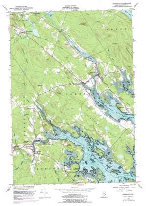
Pembroke Topo Map Maine
To zoom in, hover over the map of Pembroke
USGS Topo Quad 44067h2 - 1:24,000 scale
| Topo Map Name: | Pembroke |
| USGS Topo Quad ID: | 44067h2 |
| Print Size: | ca. 21 1/4" wide x 27" high |
| Southeast Coordinates: | 44.875° N latitude / 67.125° W longitude |
| Map Center Coordinates: | 44.9375° N latitude / 67.1875° W longitude |
| U.S. State: | ME |
| Filename: | o44067h2.jpg |
| Download Map JPG Image: | Pembroke topo map 1:24,000 scale |
| Map Type: | Topographic |
| Topo Series: | 7.5´ |
| Map Scale: | 1:24,000 |
| Source of Map Images: | United States Geological Survey (USGS) |
| Alternate Map Versions: |
Pembroke ME 1949, updated 1952 Download PDF Buy paper map Pembroke ME 1949, updated 1963 Download PDF Buy paper map Pembroke ME 1949, updated 1975 Download PDF Buy paper map Pembroke ME 1949, updated 1978 Download PDF Buy paper map Pembroke ME 2011 Download PDF Buy paper map Pembroke ME 2014 Download PDF Buy paper map |
1:24,000 Topo Quads surrounding Pembroke
> Back to 44067e1 at 1:100,000 scale
> Back to 44066a1 at 1:250,000 scale
> Back to U.S. Topo Maps home
Pembroke topo map: Gazetteer
Pembroke: Bars
Herseys Upper Ledge elevation 0m 0′Middle Ground elevation 0m 0′
Pembroke: Bays
Bellier Cove elevation 0m 0′Dennys Bay elevation 0m 0′
Duck Harbor elevation 0m 0′
Hersey Cove elevation 0m 0′
Ox Cove elevation 0m 0′
Youngs Cove elevation 0m 0′
Pembroke: Capes
Clark Point elevation 18m 59′Hardy Point elevation 1m 3′
Hersey Neck elevation 22m 72′
Hersey Point elevation 11m 36′
Hunkley Point elevation 13m 42′
Hurley Point elevation 7m 22′
Leighton Neck elevation 17m 55′
Mahar Point elevation 8m 26′
Reynolds Point elevation 3m 9′
Wilbur Neck elevation 13m 42′
Pembroke: Channels
Cobscook Falls elevation 0m 0′Pembroke: Dams
Lower River Dam elevation 15m 49′Pembroke Cottage Dam elevation 15m 49′
Pennamaquan River Dam elevation 23m 75′
Pembroke: Islands
Burnt Island elevation 0m 0′Dram Island elevation 20m 65′
Little Dram Island elevation 1m 3′
Sal Seal Island elevation 0m 0′
Smalls Island elevation 0m 0′
Two Hour Rock elevation 0m 0′
Williams Island elevation 3m 9′
Pembroke: Parks
Dennysville Historic District elevation 6m 19′Reversing Falls Park elevation 12m 39′
Pembroke: Populated Places
Ayers elevation 30m 98′Dennysville elevation 10m 32′
Imnarkuan (historical) elevation 13m 42′
Lower Dennysville elevation 19m 62′
Pembroke elevation 13m 42′
West Pembroke elevation 17m 55′
Pembroke: Post Offices
Ayers Post Office elevation 31m 101′Pembroke: Reservoirs
Pennamaquan River Reservoir elevation 15m 49′Pembroke: Streams
Cathance Stream elevation 7m 22′Chandler Brook elevation 24m 78′
Crow Brook elevation 7m 22′
Dennys River elevation 0m 0′
Hardscrabble River elevation 0m 0′
Hobart Stream elevation 2m 6′
Meadow Brook elevation 0m 0′
Meadow Brook elevation 18m 59′
Sipp Brook elevation 7m 22′
Willow Brook elevation 6m 19′
Wilson Stream elevation 3m 9′
Pembroke: Summits
Big Hill elevation 61m 200′Coggins Head elevation 43m 141′
Eastman Hill elevation 65m 213′
Ironworks Mountain elevation 54m 177′
King David Hill elevation 55m 180′
Leighton Ledges elevation 35m 114′
Meadow Mountain elevation 30m 98′
Mount Dorcas elevation 55m 180′
Oak Hill elevation 72m 236′
Page Hill elevation 66m 216′
Pembroke digital topo map on disk
Buy this Pembroke topo map showing relief, roads, GPS coordinates and other geographical features, as a high-resolution digital map file on DVD:
Maine, New Hampshire, Rhode Island & Eastern Massachusetts
Buy digital topo maps: Maine, New Hampshire, Rhode Island & Eastern Massachusetts


