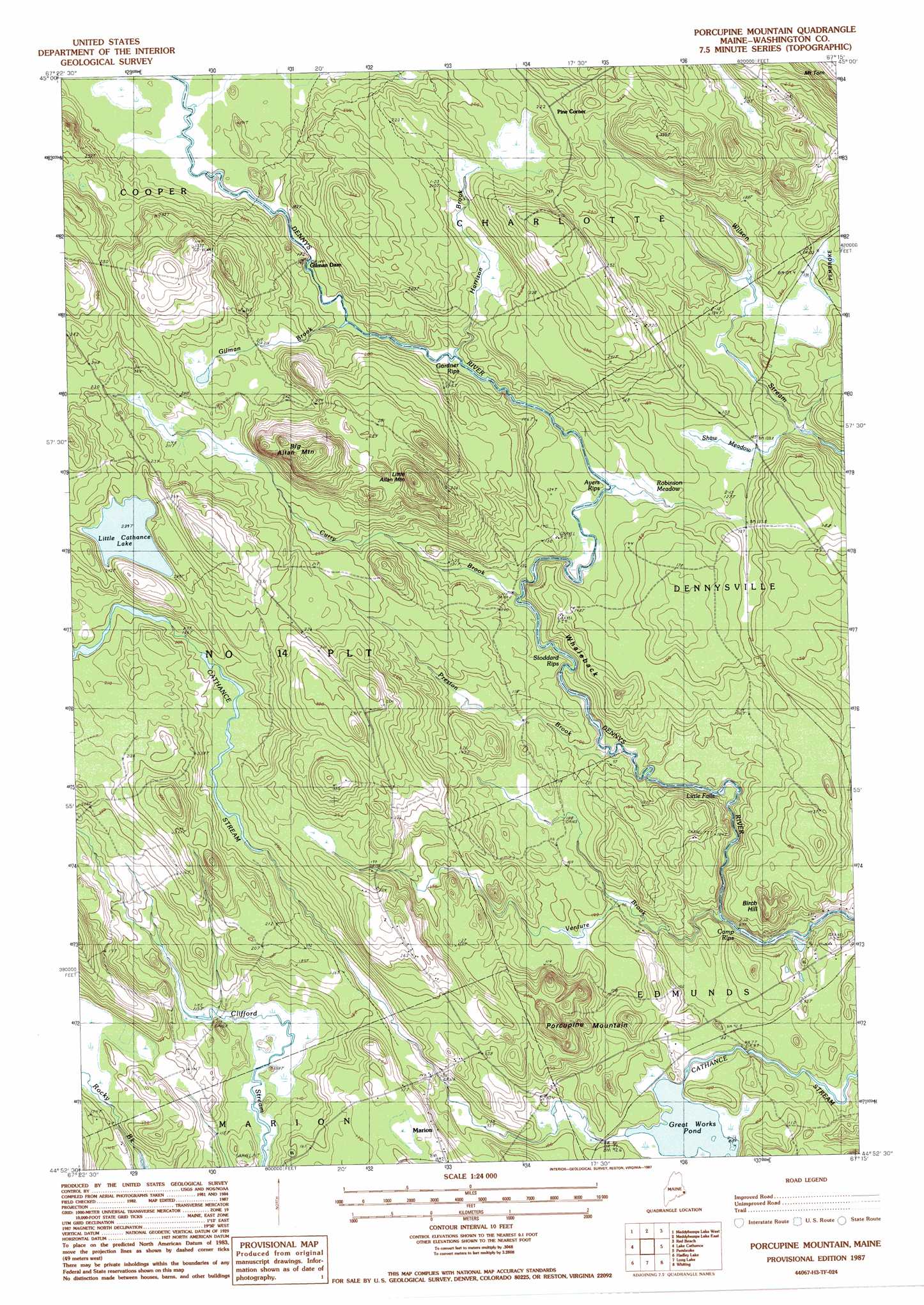
Porcupine Mountain Topo Map Maine
To zoom in, hover over the map of Porcupine Mountain
USGS Topo Quad 44067h3 - 1:24,000 scale
| Topo Map Name: | Porcupine Mountain |
| USGS Topo Quad ID: | 44067h3 |
| Print Size: | ca. 21 1/4" wide x 27" high |
| Southeast Coordinates: | 44.875° N latitude / 67.25° W longitude |
| Map Center Coordinates: | 44.9375° N latitude / 67.3125° W longitude |
| U.S. State: | ME |
| Filename: | o44067h3.jpg |
| Download Map JPG Image: | Porcupine Mountain topo map 1:24,000 scale |
| Map Type: | Topographic |
| Topo Series: | 7.5´ |
| Map Scale: | 1:24,000 |
| Source of Map Images: | United States Geological Survey (USGS) |
| Alternate Map Versions: |
Porcupine Mountain ME 1987, updated 1987 Download PDF Buy paper map Porcupine Mountain ME 2011 Download PDF Buy paper map Porcupine Mountain ME 2014 Download PDF Buy paper map |
1:24,000 Topo Quads surrounding Porcupine Mountain
Princeton |
Woodland |
Calais |
Devils Head |
|
Crawford Lake |
Meddybemp Lake West |
Meddybemp Lake East |
Red Beach |
Robbinston |
Round Lake |
Lake Cathance |
Porcupine Mountain |
Pembroke |
Eastport |
Bog Lake |
Hadley Lake |
Long Lake |
Whiting |
West Lubec |
Whitneyville |
Machias |
Machias Bay |
Cutler |
Moose River |
> Back to 44067e1 at 1:100,000 scale
> Back to 44066a1 at 1:250,000 scale
> Back to U.S. Topo Maps home
Porcupine Mountain topo map: Gazetteer
Porcupine Mountain: Dams
Great Works Dam elevation 23m 75′Porcupine Mountain: Falls
Little Falls elevation 22m 72′Porcupine Mountain: Islands
Bright Island elevation 36m 118′Porcupine Mountain: Lakes
Little Cathance Lake elevation 73m 239′Porcupine Mountain: Parks
Great Works Wildlife Management Area elevation 25m 82′Porcupine Mountain: Populated Places
Marion elevation 49m 160′Pine Corner elevation 68m 223′
Porcupine Mountain: Rapids
Ayers Rips elevation 35m 114′Camp Rips elevation 18m 59′
Gardner Rips elevation 41m 134′
Stoddard Rips elevation 33m 108′
Porcupine Mountain: Reservoirs
Great Works Pond elevation 23m 75′Porcupine Mountain: Ridges
Whaleback elevation 50m 164′Porcupine Mountain: Streams
Curry Brook elevation 33m 108′Gilman Brook elevation 44m 144′
Harrison Brook elevation 43m 141′
Preston Brook elevation 28m 91′
Venture Brook elevation 20m 65′
Porcupine Mountain: Summits
Big Allan Mountain elevation 133m 436′Birch Hill elevation 62m 203′
Little Allan Mountain elevation 117m 383′
Porcupine Mountain elevation 71m 232′
Porcupine Mountain: Swamps
Robinson Meadow elevation 35m 114′Shaw Meadow elevation 38m 124′
Porcupine Mountain digital topo map on disk
Buy this Porcupine Mountain topo map showing relief, roads, GPS coordinates and other geographical features, as a high-resolution digital map file on DVD:
Maine, New Hampshire, Rhode Island & Eastern Massachusetts
Buy digital topo maps: Maine, New Hampshire, Rhode Island & Eastern Massachusetts