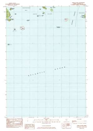
Johns Island Topo Map Maine
To zoom in, hover over the map of Johns Island
USGS Topo Quad 44068a4 - 1:24,000 scale
| Topo Map Name: | Johns Island |
| USGS Topo Quad ID: | 44068a4 |
| Print Size: | ca. 21 1/4" wide x 27" high |
| Southeast Coordinates: | 44° N latitude / 68.375° W longitude |
| Map Center Coordinates: | 44.0625° N latitude / 68.4375° W longitude |
| U.S. State: | ME |
| Filename: | o44068a4.jpg |
| Download Map JPG Image: | Johns Island topo map 1:24,000 scale |
| Map Type: | Topographic |
| Topo Series: | 7.5´ |
| Map Scale: | 1:24,000 |
| Source of Map Images: | United States Geological Survey (USGS) |
| Alternate Map Versions: |
Johns Island ME 1983, updated 1983 Download PDF Buy paper map Johns Island ME 2011 Download PDF Buy paper map Johns Island ME 2014 Download PDF Buy paper map |
1:24,000 Topo Quads surrounding Johns Island
Sargentville |
Brooklin |
Bartlett Island |
Southwest Harbor |
Seal Harbor |
Deer Isle |
Stinson Neck |
Swans Island |
Bass Harbor |
Baker Island |
Isle Au Haut West |
Isle Au Haut East |
Johns Island |
Frenchboro |
|
Matinicus |
> Back to 44068a1 at 1:100,000 scale
> Back to 44068a1 at 1:250,000 scale
> Back to U.S. Topo Maps home
Johns Island topo map: Gazetteer
Johns Island: Bars
Beach Ledge elevation 0m 0′Black Ledge elevation 3m 9′
Cod Ledge elevation 0m 0′
Huron Island Point Ledge elevation 0m 0′
Johns Island Sunken Ledge elevation 0m 0′
Mason Ledge elevation 3m 9′
Sally Prude Ledge elevation 0m 0′
Scal Ledge elevation 0m 0′
Yellow Ledge elevation 3m 9′
Johns Island: Bays
Popplestone Cove elevation 0m 0′Sand Cove elevation 0m 0′
Johns Island: Capes
Gooseberry Point elevation 7m 22′Johns Island: Islands
Baker Island elevation 8m 26′Black Rock elevation 0m 0′
Brimstone Island elevation 4m 13′
Green Island elevation 8m 26′
Gunning Rock elevation 0m 0′
Heron Island elevation 10m 32′
Johns Island elevation 20m 65′
Johns Island Dry Ledge elevation 0m 0′
Ringtown Island elevation 20m 65′
Scrag Island elevation 4m 13′
Johns Island: Summits
Devils Head elevation 24m 78′Johns Island digital topo map on disk
Buy this Johns Island topo map showing relief, roads, GPS coordinates and other geographical features, as a high-resolution digital map file on DVD:
Maine, New Hampshire, Rhode Island & Eastern Massachusetts
Buy digital topo maps: Maine, New Hampshire, Rhode Island & Eastern Massachusetts


