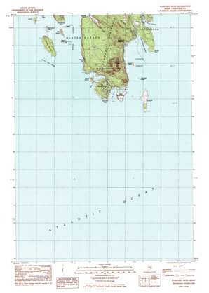
Schoodic Head Topo Map Maine
To zoom in, hover over the map of Schoodic Head
USGS Topo Quad 44068c1 - 1:24,000 scale
| Topo Map Name: | Schoodic Head |
| USGS Topo Quad ID: | 44068c1 |
| Print Size: | ca. 21 1/4" wide x 27" high |
| Southeast Coordinates: | 44.25° N latitude / 68° W longitude |
| Map Center Coordinates: | 44.3125° N latitude / 68.0625° W longitude |
| U.S. State: | ME |
| Filename: | o44068c1.jpg |
| Download Map JPG Image: | Schoodic Head topo map 1:24,000 scale |
| Map Type: | Topographic |
| Topo Series: | 7.5´ |
| Map Scale: | 1:24,000 |
| Source of Map Images: | United States Geological Survey (USGS) |
| Alternate Map Versions: |
Schoodic Head ME 1984, updated 1985 Download PDF Buy paper map Schoodic Head ME 2011 Download PDF Buy paper map Schoodic Head ME 2014 Download PDF Buy paper map |
1:24,000 Topo Quads surrounding Schoodic Head
Hancock |
Sullivan |
Tunk Lake |
Cherryfield |
Harrington |
Salsbury Cove |
Bar Harbor |
Winter Harbor |
Petit Manan Point |
Bois Bubert |
Southwest Harbor |
Seal Harbor |
Schoodic Head |
||
Bass Harbor |
Baker Island |
|||
Frenchboro |
> Back to 44068a1 at 1:100,000 scale
> Back to 44068a1 at 1:250,000 scale
> Back to U.S. Topo Maps home
Schoodic Head topo map: Gazetteer
Schoodic Head: Bars
Middle Ledge elevation 0m 0′Old Woman elevation 0m 0′
Pulpit Ledge elevation 0m 0′
Roaring Bull elevation 0m 0′
Schoodic Ledge elevation 0m 0′
Turtle Island Ledge elevation 0m 0′
White Ledge elevation 0m 0′
Schoodic Head: Bays
Arey Cove elevation 0m 0′Buck Cove elevation 0m 0′
Bunkers Harbor elevation 0m 0′
East Pond elevation 0m 0′
Schoodic Harbor elevation 0m 0′
West Pond elevation 0m 0′
Winter Harbor elevation 0m 0′
Wonsqueak Harbor elevation 0m 0′
Schoodic Head: Capes
Grindstone Point elevation 3m 9′Schoodic Peninsula elevation 24m 78′
Schoodic Point elevation 2m 6′
Spruce Point elevation 3m 9′
Schoodic Head: Cliffs
Ravens Nest elevation 11m 36′Schoodic Head: Islands
Big Moose Island elevation 29m 95′Grindstone Ledge elevation 0m 0′
Heron Island elevation 2m 6′
Little Moose Island elevation 11m 36′
Mark Island elevation 1m 3′
Ned Island elevation 13m 42′
Pond Island elevation 8m 26′
Rolling Island elevation 6m 19′
Schoodic Island elevation 3m 9′
Spectacle Island elevation 1m 3′
Turtle Island elevation 15m 49′
Schoodic Head: Streams
Frazer Creek elevation 3m 9′Mountain Brook elevation 4m 13′
Mountain Brook elevation 0m 0′
Schoodic Head: Summits
Buck Cove Mountain elevation 68m 223′Schoodic Head elevation 132m 433′
The Anvil elevation 55m 180′
Schoodic Head: Swamps
The Heath elevation 9m 29′Schoodic Head: Trails
Alder Path Trail elevation 24m 78′Schoodic Head Trail elevation 6m 19′
The Anvil Trail elevation 46m 150′
Schoodic Head digital topo map on disk
Buy this Schoodic Head topo map showing relief, roads, GPS coordinates and other geographical features, as a high-resolution digital map file on DVD:
Maine, New Hampshire, Rhode Island & Eastern Massachusetts
Buy digital topo maps: Maine, New Hampshire, Rhode Island & Eastern Massachusetts


