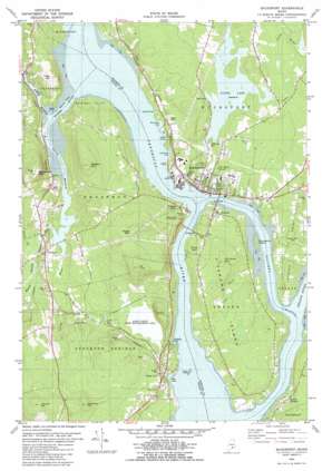
Bucksport Topo Map Maine
To zoom in, hover over the map of Bucksport
USGS Topo Quad 44068e7 - 1:24,000 scale
| Topo Map Name: | Bucksport |
| USGS Topo Quad ID: | 44068e7 |
| Print Size: | ca. 21 1/4" wide x 27" high |
| Southeast Coordinates: | 44.5° N latitude / 68.75° W longitude |
| Map Center Coordinates: | 44.5625° N latitude / 68.8125° W longitude |
| U.S. State: | ME |
| Filename: | o44068e7.jpg |
| Download Map JPG Image: | Bucksport topo map 1:24,000 scale |
| Map Type: | Topographic |
| Topo Series: | 7.5´ |
| Map Scale: | 1:24,000 |
| Source of Map Images: | United States Geological Survey (USGS) |
| Alternate Map Versions: |
Bucksport ME 1982, updated 1982 Download PDF Buy paper map Bucksport ME 1982, updated 1982 Download PDF Buy paper map Bucksport ME 2011 Download PDF Buy paper map Bucksport ME 2014 Download PDF Buy paper map |
1:24,000 Topo Quads surrounding Bucksport
> Back to 44068e1 at 1:100,000 scale
> Back to 44068a1 at 1:250,000 scale
> Back to U.S. Topo Maps home
Bucksport topo map: Gazetteer
Bucksport: Bars
Odom Ledge elevation 1m 3′Bucksport: Bays
Collins Cove elevation 4m 13′Gondola Cove elevation 3m 9′
Harriman Cove elevation 1m 3′
Lawrence Cove elevation 1m 3′
Luce Cove elevation 1m 3′
Marsh Bay elevation 1m 3′
Mill Cove elevation 5m 16′
Bucksport: Bridges
Penobscot Narrows Bridge elevation 1m 3′Verona Bridge elevation 1m 3′
Waldo-Hancock Bridge elevation 1m 3′
Bucksport: Capes
Bowden Point elevation 15m 49′Gross Point elevation 18m 59′
Treat Point elevation 1m 3′
Bucksport: Channels
Eastern Channel elevation 1m 3′Bucksport: Dams
Marsh River Dam elevation 3m 9′Silver Lake Dam elevation 38m 124′
Stowers Meadow Dam elevation 11m 36′
Bucksport: Islands
Porcupina Island elevation 11m 36′Verona Island elevation 35m 114′
Bucksport: Parks
Fort Knox State Historic Site elevation 63m 206′Sandy Point Game Management Area elevation 10m 32′
Bucksport: Populated Places
Bucksport elevation 17m 55′Prospect elevation 29m 95′
Prospect Ferry elevation 28m 91′
Sandy Point elevation 28m 91′
South Orland elevation 29m 95′
Verona elevation 23m 75′
Verona Park elevation 30m 98′
Bucksport: Reservoirs
Marsh Stream Reservoir elevation 1m 3′Silver Lake elevation 38m 124′
Stowers Meadow elevation 11m 36′
Bucksport: Streams
Carley Brook elevation 1m 3′Colson Stream elevation 1m 3′
Hawes Stream elevation 18m 59′
Marsh Stream elevation 1m 3′
North Branch Marsh River elevation 1m 3′
Orland River elevation 1m 3′
Perkins Brook elevation 16m 52′
South Branch Marsh River elevation 1m 3′
Ulmer Brook elevation 1m 3′
Bucksport: Summits
Blanchard Hill elevation 142m 465′Ersking elevation 98m 321′
Eustis Mountain elevation 167m 547′
Fletcher Hill elevation 177m 580′
Heagan Mountain elevation 162m 531′
McCloud Mountain elevation 101m 331′
Mosquito Mountain elevation 173m 567′
Mount Olive elevation 61m 200′
Mount Tuck elevation 172m 564′
Bucksport: Swamps
Stowers Meadows elevation 10m 32′Bucksport digital topo map on disk
Buy this Bucksport topo map showing relief, roads, GPS coordinates and other geographical features, as a high-resolution digital map file on DVD:
Maine, New Hampshire, Rhode Island & Eastern Massachusetts
Buy digital topo maps: Maine, New Hampshire, Rhode Island & Eastern Massachusetts


