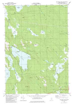
Molasses Pond Topo Map Maine
To zoom in, hover over the map of Molasses Pond
USGS Topo Quad 44068f2 - 1:24,000 scale
| Topo Map Name: | Molasses Pond |
| USGS Topo Quad ID: | 44068f2 |
| Print Size: | ca. 21 1/4" wide x 27" high |
| Southeast Coordinates: | 44.625° N latitude / 68.125° W longitude |
| Map Center Coordinates: | 44.6875° N latitude / 68.1875° W longitude |
| U.S. State: | ME |
| Filename: | o44068f2.jpg |
| Download Map JPG Image: | Molasses Pond topo map 1:24,000 scale |
| Map Type: | Topographic |
| Topo Series: | 7.5´ |
| Map Scale: | 1:24,000 |
| Source of Map Images: | United States Geological Survey (USGS) |
| Alternate Map Versions: |
Molasses Pond ME 1982, updated 1983 Download PDF Buy paper map Molasses Pond ME 2011 Download PDF Buy paper map Molasses Pond ME 2014 Download PDF Buy paper map |
1:24,000 Topo Quads surrounding Molasses Pond
> Back to 44068e1 at 1:100,000 scale
> Back to 44068a1 at 1:250,000 scale
> Back to U.S. Topo Maps home
Molasses Pond topo map: Gazetteer
Molasses Pond: Bays
Butler Cove elevation 64m 209′Deep Cove elevation 64m 209′
Molasses Pond: Bends
The Oxbow elevation 75m 246′Molasses Pond: Capes
Chez Vent elevation 67m 219′Molasses Pond: Islands
Crimmins Island elevation 67m 219′Molasses Pond: Lakes
Clark Pond elevation 70m 229′Molasses Pond elevation 64m 209′
Scammon Pond elevation 42m 137′
Molasses Pond: Parks
Lyle Frost Wildlife Management Area elevation 47m 154′Molasses Pond: Ridges
Martin Ridge elevation 161m 528′Myrick Ridge elevation 141m 462′
Neck Ridge elevation 112m 367′
Molasses Pond: Streams
Clark Meadow Brook elevation 68m 223′Macomber Mill Stream elevation 69m 226′
Roaring Brook elevation 64m 209′
Molasses Pond: Summits
Beech Knoll elevation 177m 580′Birch Hill elevation 145m 475′
Bull Hill elevation 178m 583′
Hardwood Hill elevation 172m 564′
Heifer Hill elevation 121m 396′
Little Bull Hill elevation 168m 551′
Little Hardwood Hill elevation 138m 452′
Mud Brook Ridge elevation 86m 282′
Sparrow Hill elevation 141m 462′
Sugar Hill elevation 157m 515′
Molasses Pond: Swamps
Austins Dam Heath elevation 100m 328′Clark Meadow elevation 68m 223′
Frenchs Dam Meadow elevation 93m 305′
Hooper Heath elevation 53m 173′
Mill Stream Heath elevation 72m 236′
Otter Bog elevation 64m 209′
Oxbow Heath elevation 89m 291′
Sams Heath elevation 103m 337′
Molasses Pond digital topo map on disk
Buy this Molasses Pond topo map showing relief, roads, GPS coordinates and other geographical features, as a high-resolution digital map file on DVD:
Maine, New Hampshire, Rhode Island & Eastern Massachusetts
Buy digital topo maps: Maine, New Hampshire, Rhode Island & Eastern Massachusetts


