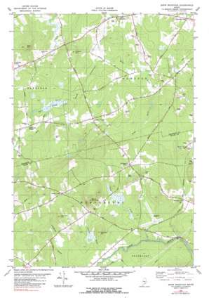
Snow Mountain Topo Map Maine
To zoom in, hover over the map of Snow Mountain
USGS Topo Quad 44068f8 - 1:24,000 scale
| Topo Map Name: | Snow Mountain |
| USGS Topo Quad ID: | 44068f8 |
| Print Size: | ca. 21 1/4" wide x 27" high |
| Southeast Coordinates: | 44.625° N latitude / 68.875° W longitude |
| Map Center Coordinates: | 44.6875° N latitude / 68.9375° W longitude |
| U.S. State: | ME |
| Filename: | o44068f8.jpg |
| Download Map JPG Image: | Snow Mountain topo map 1:24,000 scale |
| Map Type: | Topographic |
| Topo Series: | 7.5´ |
| Map Scale: | 1:24,000 |
| Source of Map Images: | United States Geological Survey (USGS) |
| Alternate Map Versions: |
Snow Mountain ME 1981, updated 1982 Download PDF Buy paper map Snow Mountain ME 1982, updated 1982 Download PDF Buy paper map Snow Mountain ME 1982, updated 1991 Download PDF Buy paper map Snow Mountain ME 2011 Download PDF Buy paper map Snow Mountain ME 2014 Download PDF Buy paper map |
1:24,000 Topo Quads surrounding Snow Mountain
> Back to 44068e1 at 1:100,000 scale
> Back to 44068a1 at 1:250,000 scale
> Back to U.S. Topo Maps home
Snow Mountain topo map: Gazetteer
Snow Mountain: Lakes
Alger Pond elevation 76m 249′Snow Mountain: Populated Places
Ellingwood Corner elevation 92m 301′Hampden Center elevation 66m 216′
Nealeys Corner elevation 102m 334′
Newburgh Village elevation 62m 203′
West Hampden elevation 54m 177′
Whites Corner elevation 114m 374′
Snow Mountain: Streams
Brown Brook elevation 48m 157′Clark Brook elevation 30m 98′
Clements Brook elevation 42m 137′
Snow Mountain: Summits
Fred Low Hill elevation 153m 501′Kelly Mountain elevation 171m 561′
Oak Hill elevation 113m 370′
Partridge Hill elevation 112m 367′
Pickard Hill elevation 119m 390′
Snow Mountain elevation 211m 692′
Snow Mountain: Swamps
Burnt Swamp elevation 59m 193′Snow Mountain digital topo map on disk
Buy this Snow Mountain topo map showing relief, roads, GPS coordinates and other geographical features, as a high-resolution digital map file on DVD:
Maine, New Hampshire, Rhode Island & Eastern Massachusetts
Buy digital topo maps: Maine, New Hampshire, Rhode Island & Eastern Massachusetts


