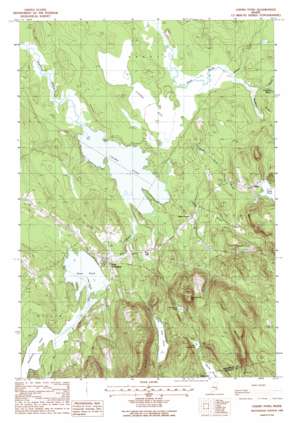
Chemo Pond Topo Map Maine
To zoom in, hover over the map of Chemo Pond
USGS Topo Quad 44068g5 - 1:24,000 scale
| Topo Map Name: | Chemo Pond |
| USGS Topo Quad ID: | 44068g5 |
| Print Size: | ca. 21 1/4" wide x 27" high |
| Southeast Coordinates: | 44.75° N latitude / 68.5° W longitude |
| Map Center Coordinates: | 44.8125° N latitude / 68.5625° W longitude |
| U.S. State: | ME |
| Filename: | o44068g5.jpg |
| Download Map JPG Image: | Chemo Pond topo map 1:24,000 scale |
| Map Type: | Topographic |
| Topo Series: | 7.5´ |
| Map Scale: | 1:24,000 |
| Source of Map Images: | United States Geological Survey (USGS) |
| Alternate Map Versions: |
Chemo Pond ME 1988, updated 1988 Download PDF Buy paper map Chemo Pond ME 1988, updated 1988 Download PDF Buy paper map Chemo Pond ME 2011 Download PDF Buy paper map Chemo Pond ME 2014 Download PDF Buy paper map |
1:24,000 Topo Quads surrounding Chemo Pond
> Back to 44068e1 at 1:100,000 scale
> Back to 44068a1 at 1:250,000 scale
> Back to U.S. Topo Maps home
Chemo Pond topo map: Gazetteer
Chemo Pond: Lakes
Chemo Pond elevation 38m 124′Davis Pond elevation 60m 196′
Fitts Pond elevation 97m 318′
Holbrook Pond elevation 60m 196′
Little Burnt Pond elevation 115m 377′
Snowshoe Pond elevation 112m 367′
Chemo Pond: Populated Places
Clifton elevation 91m 298′East Eddington elevation 55m 180′
Chemo Pond: Streams
Bradbury Brook elevation 41m 134′Goodwin Brook elevation 44m 144′
Intervale Brook elevation 41m 134′
Kidder Brook elevation 60m 196′
Mill Brook elevation 38m 124′
Parks Pond Brook elevation 39m 127′
Sibley Brook elevation 39m 127′
Chemo Pond: Summits
Blackcap elevation 312m 1023′Pisgah Mountain elevation 234m 767′
Woodchuck Hill elevation 249m 816′
Chemo Pond: Swamps
Chemo Bog elevation 46m 150′Chemo Pond digital topo map on disk
Buy this Chemo Pond topo map showing relief, roads, GPS coordinates and other geographical features, as a high-resolution digital map file on DVD:
Maine, New Hampshire, Rhode Island & Eastern Massachusetts
Buy digital topo maps: Maine, New Hampshire, Rhode Island & Eastern Massachusetts


