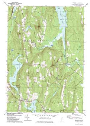
Readfield Topo Map Maine
To zoom in, hover over the map of Readfield
USGS Topo Quad 44069d8 - 1:24,000 scale
| Topo Map Name: | Readfield |
| USGS Topo Quad ID: | 44069d8 |
| Print Size: | ca. 21 1/4" wide x 27" high |
| Southeast Coordinates: | 44.375° N latitude / 69.875° W longitude |
| Map Center Coordinates: | 44.4375° N latitude / 69.9375° W longitude |
| U.S. State: | ME |
| Filename: | o44069d8.jpg |
| Download Map JPG Image: | Readfield topo map 1:24,000 scale |
| Map Type: | Topographic |
| Topo Series: | 7.5´ |
| Map Scale: | 1:24,000 |
| Source of Map Images: | United States Geological Survey (USGS) |
| Alternate Map Versions: |
Readfield ME 1980, updated 1980 Download PDF Buy paper map Readfield ME 2000, updated 2001 Download PDF Buy paper map Readfield ME 2011 Download PDF Buy paper map Readfield ME 2014 Download PDF Buy paper map |
1:24,000 Topo Quads surrounding Readfield
> Back to 44069a1 at 1:100,000 scale
> Back to 44068a1 at 1:250,000 scale
> Back to U.S. Topo Maps home
Readfield topo map: Gazetteer
Readfield: Airports
Seven G's Seaplane Base elevation 100m 328′Readfield: Dams
Grist Mill Pond Dam elevation 80m 262′Long Pond Storage Dam elevation 73m 239′
Torsey Lake Dam elevation 80m 262′
Readfield: Islands
Green Island elevation 72m 236′Readfield: Lakes
Desert Pond elevation 93m 305′Hopkins Pond elevation 99m 324′
Inghan Pond elevation 72m 236′
Minnehonk Lake elevation 100m 328′
Moose Pond elevation 121m 396′
Readfield: Populated Places
Dunns Corners elevation 122m 400′Locks Corner elevation 76m 249′
Readfield elevation 86m 282′
Readfield Depot elevation 97m 318′
Wings Mills elevation 82m 269′
Readfield: Reservoirs
Grist Mill Pond elevation 80m 262′Long Pond elevation 73m 239′
Torsey Lake elevation 80m 262′
Readfield: Streams
Bog Stream elevation 72m 236′Ingham Stream elevation 72m 236′
Intervale Brook elevation 80m 262′
Meadow Brook elevation 71m 232′
Moose Pond Stream elevation 74m 242′
Tingley Brook elevation 64m 209′
Readfield: Summits
Bowen Hill elevation 238m 780′Hornbeam Mountain elevation 204m 669′
Readfield: Swamps
Weston Meadow elevation 74m 242′Readfield digital topo map on disk
Buy this Readfield topo map showing relief, roads, GPS coordinates and other geographical features, as a high-resolution digital map file on DVD:
Maine, New Hampshire, Rhode Island & Eastern Massachusetts
Buy digital topo maps: Maine, New Hampshire, Rhode Island & Eastern Massachusetts


