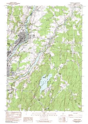
Fairfield Topo Map Maine
To zoom in, hover over the map of Fairfield
USGS Topo Quad 44069e5 - 1:24,000 scale
| Topo Map Name: | Fairfield |
| USGS Topo Quad ID: | 44069e5 |
| Print Size: | ca. 21 1/4" wide x 27" high |
| Southeast Coordinates: | 44.5° N latitude / 69.5° W longitude |
| Map Center Coordinates: | 44.5625° N latitude / 69.5625° W longitude |
| U.S. State: | ME |
| Filename: | o44069e5.jpg |
| Download Map JPG Image: | Fairfield topo map 1:24,000 scale |
| Map Type: | Topographic |
| Topo Series: | 7.5´ |
| Map Scale: | 1:24,000 |
| Source of Map Images: | United States Geological Survey (USGS) |
| Alternate Map Versions: |
Waterville SE ME 1975, updated 1980 Download PDF Buy paper map Fairfield ME 1982, updated 1983 Download PDF Buy paper map Fairfield ME 1982, updated 1991 Download PDF Buy paper map Fairfield ME 2011 Download PDF Buy paper map Fairfield ME 2014 Download PDF Buy paper map |
1:24,000 Topo Quads surrounding Fairfield
> Back to 44069e1 at 1:100,000 scale
> Back to 44068a1 at 1:250,000 scale
> Back to U.S. Topo Maps home
Fairfield topo map: Gazetteer
Fairfield: Airports
Bob-Mar Airport elevation 87m 285′Fairfield: Crossings
Interchange 35 elevation 55m 180′Interchange 36 elevation 39m 127′
Fairfield: Dams
T and A Mills Dam elevation 16m 52′Fairfield: Islands
East Island elevation 23m 75′Gulliver Island elevation 24m 78′
Libbey Island elevation 28m 91′
Lily Island elevation 27m 88′
Middle Island elevation 24m 78′
Fairfield: Lakes
Pattee Pond elevation 43m 141′Fairfield: Parks
Monument Park elevation 49m 160′Fairfield: Populated Places
Benton elevation 30m 98′Benton Falls elevation 48m 157′
Benton Station elevation 47m 154′
East Winslow elevation 60m 196′
Fairfield elevation 43m 141′
Goodwin Corner elevation 49m 160′
Hayden Corner elevation 44m 144′
Lambs Corner elevation 94m 308′
Paines Corner elevation 69m 226′
Winslow elevation 43m 141′
Fairfield: Post Offices
Fairfield Post Office (historical) elevation 31m 101′Fairfield: Reservoirs
Kennebec River Reservoir elevation 16m 52′Fairfield: Streams
Bellows Stream elevation 44m 144′Emery Brook elevation 27m 88′
Holland Brook elevation 22m 72′
Outlet Stream elevation 12m 39′
Pattee Pond Brook elevation 15m 49′
Wilson Brook elevation 62m 203′
Fairfield: Summits
Baker Hill elevation 146m 479′Fairfield digital topo map on disk
Buy this Fairfield topo map showing relief, roads, GPS coordinates and other geographical features, as a high-resolution digital map file on DVD:
Maine, New Hampshire, Rhode Island & Eastern Massachusetts
Buy digital topo maps: Maine, New Hampshire, Rhode Island & Eastern Massachusetts


