Burnham Topo Map Maine
To zoom in, hover over the map of Burnham
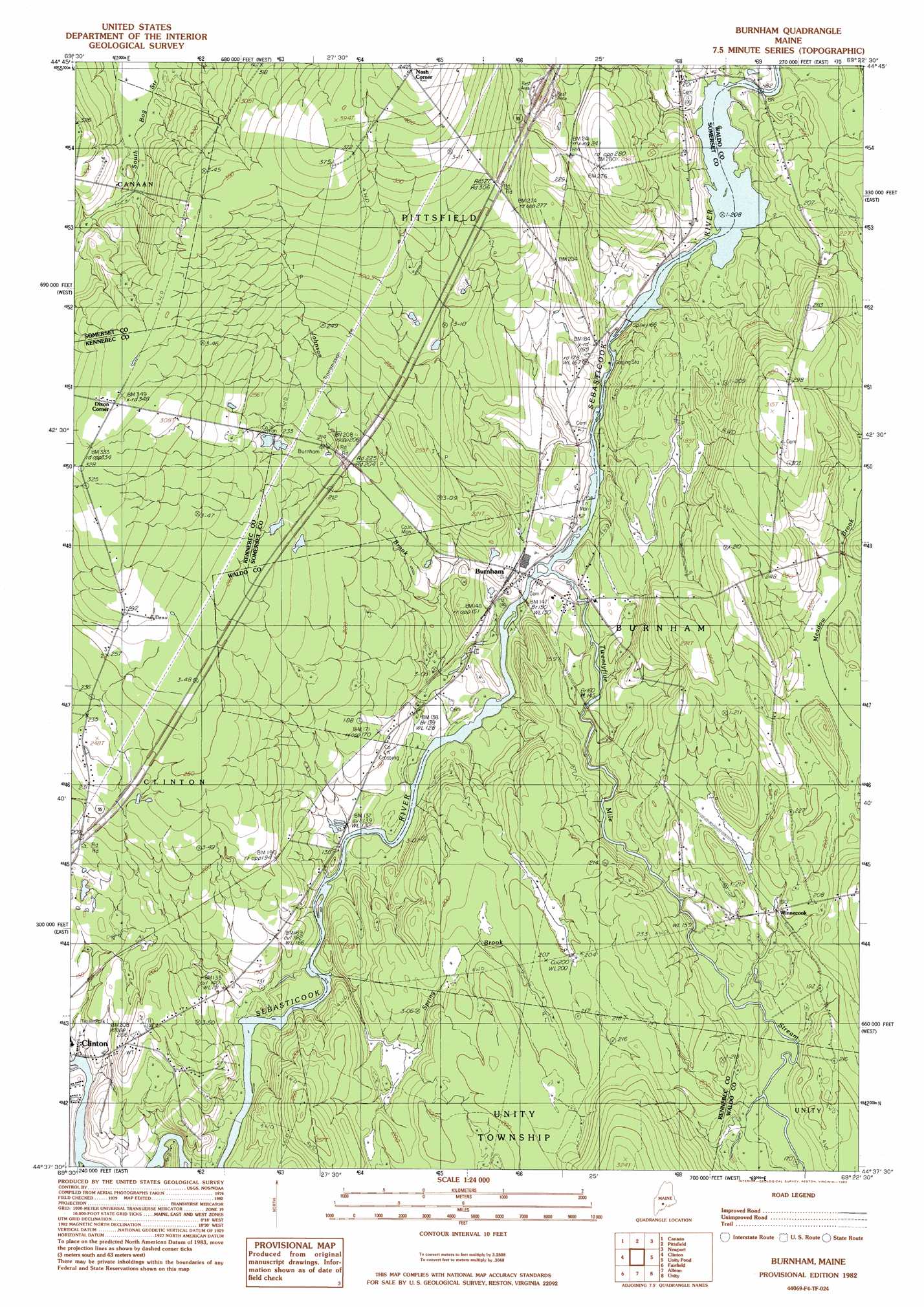
USGS Topo Quad 44069f4 - 1:24,000 scale
| Topo Map Name: | Burnham |
| USGS Topo Quad ID: | 44069f4 |
| Print Size: | ca. 21 1/4" wide x 27" high |
| Southeast Coordinates: | 44.625° N latitude / 69.375° W longitude |
| Map Center Coordinates: | 44.6875° N latitude / 69.4375° W longitude |
| U.S. State: | ME |
| Filename: | o44069f4.jpg |
| Download Map JPG Image: | Burnham topo map 1:24,000 scale |
| Map Type: | Topographic |
| Topo Series: | 7.5´ |
| Map Scale: | 1:24,000 |
| Source of Map Images: | United States Geological Survey (USGS) |
| Alternate Map Versions: |
Burnham NW ME 1975, updated 1980 Download PDF Buy paper map Burnham ME 1982, updated 1983 Download PDF Buy paper map Burnham ME 2011 Download PDF Buy paper map Burnham ME 2014 Download PDF Buy paper map |
1:24,000 Topo Quads surrounding Burnham
Arbens |
Harmony |
Hartland |
Corinna |
Stetson |
Skowhegan |
Canaan |
Pittsfield |
Newport |
Plymouth |
Hinckley |
Clinton |
Burnham |
Unity Pond |
Dixmont |
Waterville |
Fairfield |
Albion |
Unity |
Brooks West |
Vassalboro |
China Lake |
Palermo |
Liberty |
Morrill |
> Back to 44069e1 at 1:100,000 scale
> Back to 44068a1 at 1:250,000 scale
> Back to U.S. Topo Maps home
Burnham topo map: Gazetteer
Burnham: Bridges
Elweir Bridge elevation 49m 160′Burnham: Dams
Burnham Dam elevation 48m 157′Burnham: Populated Places
Burnham elevation 43m 141′Dixon Corner elevation 104m 341′
Nash Corner elevation 134m 439′
Winnecook elevation 57m 187′
Burnham: Reservoirs
Sebasticook River Reservoir elevation 49m 160′Burnham: Streams
Johnson Brook elevation 38m 124′Spring Brook elevation 36m 118′
Twentyfive Mile Stream elevation 44m 144′
Burnham digital topo map on disk
Buy this Burnham topo map showing relief, roads, GPS coordinates and other geographical features, as a high-resolution digital map file on DVD:
Maine, New Hampshire, Rhode Island & Eastern Massachusetts
Buy digital topo maps: Maine, New Hampshire, Rhode Island & Eastern Massachusetts